Back Bay National Wildlife Refuge Trail System
check with the trail manager for updated details before visiting.
Back Bay National Wildlife Refuge Trail System
U.S. Fish and Wildlife Service
Backcountry Trail
- Length
2.7 miles
- Elevation Gain
--
- Route Type
Loop
(1 review)
- Length
2.7 miles - Elevation Gain
-- - Route Type
Loop
The Trail System consists of seven trails, accessible from the Visitor Center, that provide the opportunity to observe the seven distinct habitats of back Bay National Wildlife Refuge (BBNWR( and its wildlife and vegetation. The refuge is located on a thin barrier spit, with the Atlantic Ocean to the east and Back Bay to the west, separated by only 1/4 mile in some spots. The diversity of habitat - ocean, beach, marsh, shrubs, grassland, maritime forest and freshwater bay provides an extensive outdoor environmental classroom. Trail surfaces vary from boardwalk, crushed stone, sand and gravel. All trails are located so as to provide safe viewing for wildlife and visitor.
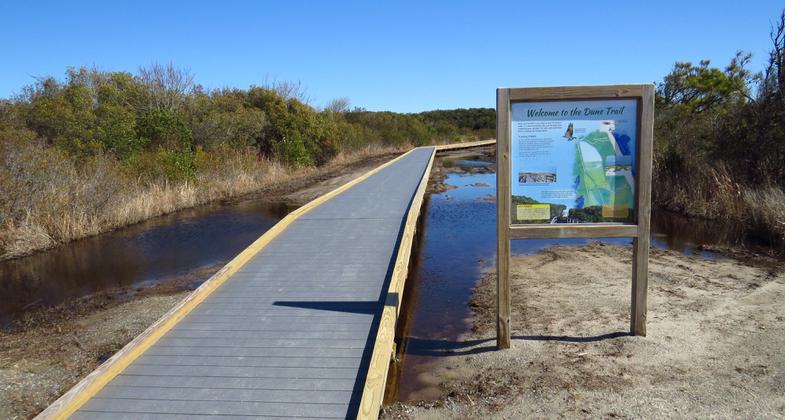
Dune Trail. Photo by U.S. Fish and Wildlife Service. Photo by USFWS
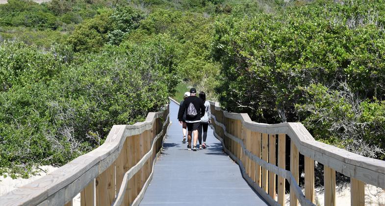
Hikers on Dune Trail. Photo by Reese Lukei, Jr.
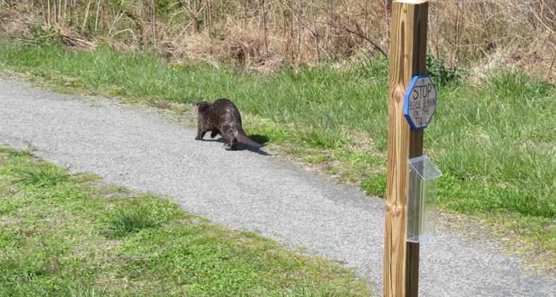
People aren't the only ones that use the trail. Photo by U.S. Fish and Wildlife Service.
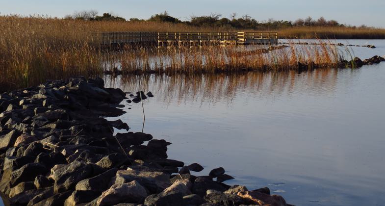
Sunset Point Overlook Platform. Photo by U.S. Fish and Wildlife Service.
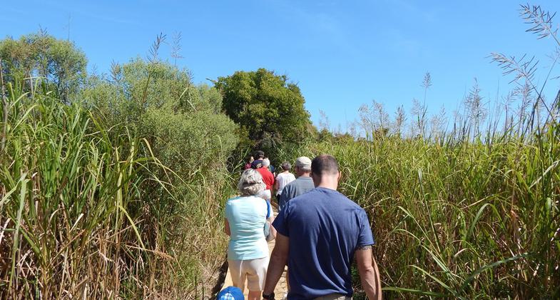
Raptor Trail. Photo by U.S. Fish and Wildlife Service.
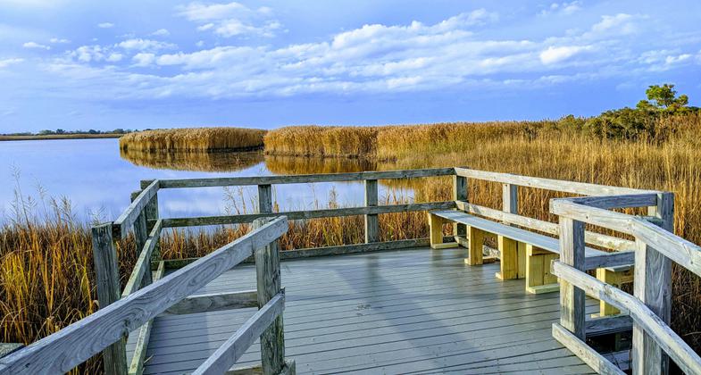
Kuralt Trail. Photo by U.S. Fish and Wildlife Service.
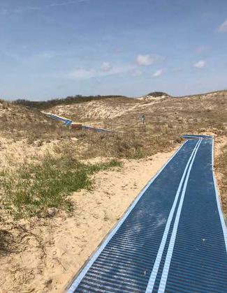
Seaside Trail. Photo by U.S. Fish and Wildlife Service.
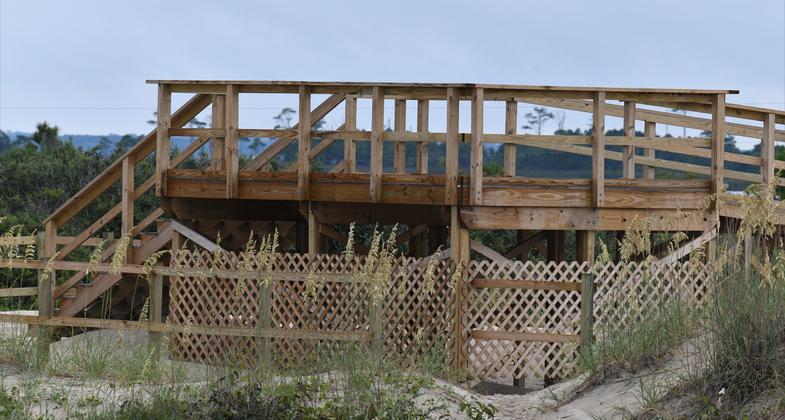
Dune Trail Observation Platform Photo by Reese F. Lukei, Jr.
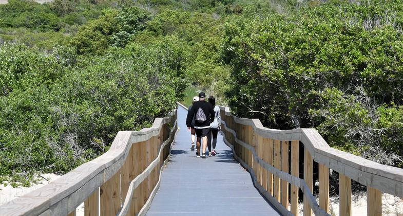
Dune Trail Photo by Reese F. Lukei, Jr.
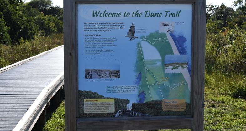
Dune Trail Sign Photo by Reese F. Lukei, Jr.
Location: Back Bay National Wildlife Refuge Virginia Beach, VA
- States: Virginia
- Counties: Virginia Beach
- Cities/Townships: Virginia Beach
Back Bay National Wildlife Refuge (BBNWR) was established in 1938 and is one of more than 565 refuges administered by the U.S. Fish and Wildlife Service. The National Wildlife Refuge System is the only network of lands and water managed specifically for the protection of wildlife management in the world. The character of the refuges is as diverse as the nation itself.
BBNWR encompasses more than 9,175 acres and is managed primarily for migratory birds, particularly for wintering waterfowl, migratory shorebirds, and wading birds. It is located along the Atlantic Flyway adjacent to the Atlantic Ocean and Back Bay, completely within the city of Virginia Beach in southeast Virginia, a vibrant coastal community. BBNWR is comprised of emergent freshwater marsh, beach, dune, grassland shrub, and maritime forest, all of which provide excellent opportunities for birding. More than 300 species of birds have been recorded on the refuge. It has a 950-acre freshwater impoundment complex fed by water from Back Bay, managed specifically to provide a habitat for migratory birds.
During the winter months, the refuge supports thousands of tundra swan, snow and Canada geese, a wide variety of duck species, as well as a plethora of Wading birds, shorebirds, and songbirds. In spring and summer months songbirds, osprey, and bald eagles return to breed, and sea turtles, including loggerheads, travel to BBNWR beaches, which are the northernmost tip of their breeding range.
In addition to the wildlife, the refuge hosts between 115,000 and 215,000 visitors annually from all over the world. Visitors come to enjoy the exceptional birding opportunities, both saltwater and freshwater fishing, kayaking and canoeing, photography, and environmental education and interpretive programs. Guided interpretive tram tours are offered to visitors through BBNWR into neighboring False Cape State Park. A recently renovated Visitor Center offers information about the refuge, brochures, and wildlife displays.
The Trail System at BBNWR is a component of the Virginia Beach Bikeways and Trails network. Charles Kuralt, a native of North Carolina, was a distinguished radio and broadcast journalist who had a long-time interest in national wildlife refuges. He was recognized by the U.S. Fish and Wildlife with the Citizen's Award. Upon his death, eleven national wildlife refuges and a fish hatchery in the mid-Atlantic coastal plain of North Carolina and Virginia, including BBNWR, joined together to form the Charles Kuralt Trail system. Currently, there are 76 National Recreation Trails on refuges managed by the U.S. Fish and Wildlife Service The Trail System at BBNWR would be the first National Recreation Trail designated on a national wildlife refuge in Virginia.
The trail system is comprised of these seven trails:
Charles Kuralt Trail
One of 12 trails named in honor of Charles Kuralt. It begins at the Visitor Center parking lot and continues on a boardwalk to an elevated overlook.
Length - .10 mile
Elevation 4 to 6 feet
Surface - Boardwalk
Overlook - Yes
Loop - No
Handicapped access - Yes
Kiosk - Yes
Seaside Trail
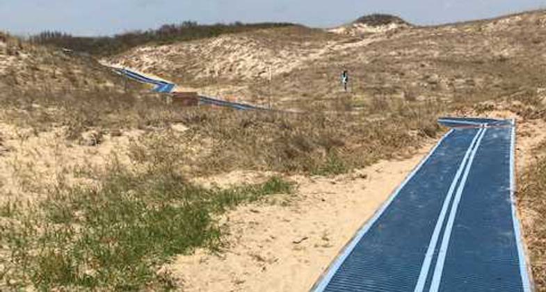
Begins across from the Visitor Center on newly installed Mobi-Mat RecPath matting, completed July 2021. This trail crosses shrub-covered sand dunes eastward to the beach along the Atlantic Ocean.
Length - .16 mile
Surface - Mobi-Mat RecPath and sand
Elevation - 4 to 15 feet
Overlook - No
Loop - Yes, in combination with the Dune and East Dike trails
Handicapped access - No
Trail Sign - Yes
Dune Trail
Begins at the East Dike Trail, on a boardwalk built in 2021 (which replaced a previous boardwalk), eastward over freshwater marsh and shrub-covered sand dunes to the beach along the Atlantic Ocean.
Length - .16 mile
Surface - Boardwalk and sand
Elevation 5 to 20 feet (at overlook)
Overlook - Yes
Loop - Yes, in combination with Seaside and East Dike trails
Handicapped access - No
Trail Sign - Yes
Reese F. Lukei, Jr. Raptor Trail
One of seven local trails named for his long-time volunteer work with raptor research, wildlife education, and nature trails. This trail begins near the Visitor Center and heads south through the maritime forest to the edge of Back Bay.
Length - .45 mile
Surface - Boardwalk and crushed rock
Elevation - 4 to 6 feet
Overlook - Yes, two
Loop - Yes, in combination with Sunset Point Trail
Handicapped access - Yes
Trail Sign - Yes
Sunset Point Trail
Begins at the Visitor Center and heads south on a crushed rock trail past an observation platform over a freshwater pond, used for environmental education workshops, then becomes a boardwalk as the trail enters the Maritime forest. The trail continues on a boardwalk over the freshwater marsh, past a boardwalk that leads to the Raptor Trail, and to an observation overlook on Back Bay. From there the trail turns north on a boardwalk and crushed rock past the refuge boat launch and the canoe/kayak launch ending at the Visitor Center parking lot.
Length - .40 mile
Surface - Boardwalk and crushed rock
Elevation - 2 to 5 feet
Overlook - Yes
Environmental Education Platform - Yes
Loop - Yes with Raptor Trail
Handicapped access - Yes
Trail Sign - Yes
East Dike Trail
This trail begins at the Seaside Trail across from the Visitor Center and heads south on the gravel road to the Wildlife Observation building, overlooking a freshwater impoundment. It connects the Seaside and Dune trails as well as a short cross-dike road to the West Dike Trail.
Length - .82 mile
Surface - Gravel
Elevation - 4 to 6 feet
Overlook - No
Wildlife Observation building - Yes
Loop - Yes, in combination with Seaside and Dune trails or with West Dike Trail
Handicapped access - No
Trail Sign - Yes
West Dike Trail
This trail begins at the junction of the East Dike Trail and passes a fishing platform on the D pool in the freshwater impound system.
Length - .61 mile
Surface - Gravel
Elevation 4 to 5 feet
Overlook - No
Fishing Platform - Yes
Loop, Yes, in combination with East Dike Trail
Handicapped access - No
Trail Sign - Yes
Accessibility Information
No text provided.
Reviews
D.R. Ford
Exploring Nature from the Seashore to Maritime Forest to the marshes.
Not to be partial but having lived in Virginia Beach for over 60 years and reacquainting myself with the beauty and tranquility of Back Bay National Wildlife Refuge, I find this National Recreation Trail recognition as an outstanding opportunity for outdoor enthusiast around the world to enjoy! Not only is this a migratory fall/winter stop along the Atlantic flyway but is One of the most northern locations for sea turtle nestling in the summer. With the seven trails available for hiking, From the seashore to the marshes and in between, you can venture diverse habitats within hours! Enjoy this pristine treasure in Virginia Beach.
Allowed Uses:
Bicycling Hiking/WalkingOther Activities
- Fishing
- Wildlife viewing / observation
Public Contact
Megan ReedU.S. Fish and Wildlife Service
1324 Sandbridge Road
Virginia Beach, VA 23456
[email protected] • (757) 301-7329
Contact the trail manager for current maps and visiting details.
More Details
- Elevation (low): 2
- Elevation (high): 20
- Elevation (cumulative): --
- Part of a Trail System? No
- National Designations: none
- State Designations: none
- Surface (primary): Rock, crushed
- Surfaces (additional): Boardwalk, Sand
- Tread Width (average): 72"
- Tread Width (minimum): 48
- Running length (minimum): --
- Tread Grade (average, percent): --
- Tread Grade (maximum): 5
- Running length (maximum): --
- Cross-slope (average, percent): 0
- Cross-slope (maximum): --
- Running length (maximum): --
- Certified as an NRT
Jun 2, 2022

