Baldy Lookout-Lake Trail #340
This information is a public record of the 1981 NRT application and may be out of date if it has not been updated by a trail manager --
check with the trail manager for updated details before visiting.
check with the trail manager for updated details before visiting.
Baldy Lookout-Lake Trail #340
USDA Forest Service
Backcountry Trail
- Length
2.96 miles
- Elevation Gain
--
- Route Type
out & back
- Length
2.96 miles - Elevation Gain
-- - Route Type
out & back
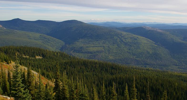
This hardcore 3.2-mile trail has steep inclines that take you 5,000 feet above the valley.

View from Baldy Lookout. Photo by Wade Moats/USFS.

Deep snow at lookout. Photo by Dave Helmrick/USFS.

Baldy Mountain Elevation sign. Photo by Wade Moats/USFS.

View of fire lookout. Photo by Wade Moats/USFS.
Location: 12 miles north of Plains, MT. Trailhead at the end of Forest Road 886
- States: Montana
- Counties: Sanders
The upper portion of the trail is very rocky. When you reach the top of Baldy Mountain, you can approach the foundation of the old lookout. Just beyond the lookout foundation, you will see your first glimpse of the basin which holds Baldy Lake. A few hundred feet away, you will be able to see the lake. The lower half of the trail is a different experience entirely, offering packs a leisurely, mostly flat walk along natural surfaces through the old-growth forest.
Accessibility Information
No text provided.
Allowed Uses:
Bicycling Swimming Dogs, on leash Equestrian Hiking/Walking Snow, cross-country skiing Snow, snowshoeingOther Activities
- Camping
- Fishing
- Snow, snow play general
- Wildlife viewing / observation
Public Contact
Marc ChildressPalins/Thompson Falls Ranger District
P.O. Box 429
Plains, MT 59859
[email protected] • (406) 826-3821
Contact the trail manager for current maps and visiting details.
More Details
- Elevation (low): 5900
- Elevation (high): 7400
- Elevation (cumulative): --
- Part of a Trail System? No
- Surface (primary): Soil
- Surfaces (additional): Soil
- Tread Width (average): 16"
- Tread Width (minimum): --
- Running length (minimum): --
- Tread Grade (average, percent): 14
- Tread Grade (maximum): 20
- Running length (maximum): --
- Cross-slope (average, percent): --
- Cross-slope (maximum): --
- Running length (maximum): --
- Certified as an NRT
May 14, 1981

