Banks - Vernonia State Trail
check with the trail manager for updated details before visiting.
Banks - Vernonia State Trail
State
Backcountry Trail
Rail Trail
- Length
21 miles
- Elevation Gain
1000
- Route Type
out & back
- Length
21 miles - Elevation Gain
1000 - Route Type
out & back
The Banks - Vernonia State Trail is a 21-mile paved rail-to-trail rout connecting the towns of Banks and Vernonia, Oregon through the foothills of Oregon’s lush coastal mountain range.
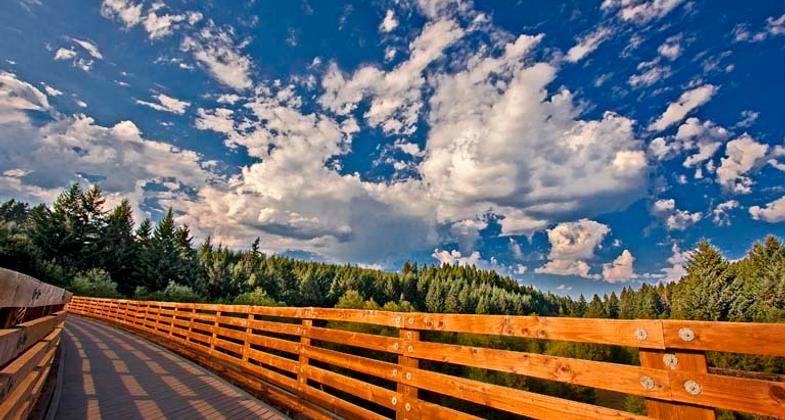
Tressel Bridge, Banks to Vernonia, Oregon. Photo by B J Imagery

Vernonia Trailhead on the Banks-Vernonia State Trail in Oregon

Banks Trailhead on the Banks-Vernonia State Trail in Oregon


Location: The Banks - Vernonia State Trail starts in the town of Banks, Oregon and traverses over twenty miles northward to Vernonia through picturesque farm and forest lands of the eastern slopes of Oregon’s coastal mountain range. 45.6651126 (North), -123.1634443 (West)
- States: Oregon
- Counties: Washington, Columbia
- Cities/Townships: Banks, Buxton, Vernonia
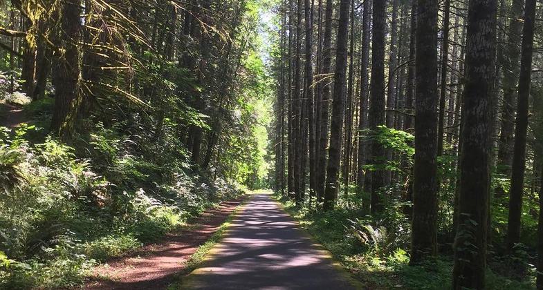
The Banks - Vernonia State Trail is the first “Rails-to-Trails” park in Oregon. The trail follows an old railroad right-of-way that stretches 21 miles between the cities of Banks and Vernonia, located in the northwest part of the state. The railway line was in operation during the 1920’s, when it was used for transporting logs, lumber, freight, and passengers. Owners included the Spokane, Portland, and Seattle Railway and Burlington Northern, until the line was abandoned, and rails salvaged in 1973. The right-of-way was purchased by the State of Oregon in 1974 and transferred to Oregon Parks and Recreation Department in 1990. Today the trail consists of a paved 8-foot-wide hiking and biking trail alongside a 4-foot-wide gravel trail that also accommodates horses. The gentle grade allows hikers, bicyclists, equestrians, and people of all ages and abilities to enjoy the scenic mountains, fields and forests of Washington and Columbia Counties. Trail highlights include 13 bridges and expansive views from the 733-foot long, 80-foot-high Buxton Trestle, which is open only to hikers and bicyclists. A ground-level equestrian bypass crosses Mendenhall Creek nearby. The south end of the trail begins in Banks, a town of 1,900 surrounded by agricultural operations. Heading north, the trail passes through agricultural fields and riparian areas before reaching the thickly-forested foothills of the Coast Range. The trail ends in Vernonia, a town of 2,200 surrounded by small farms and private timberland.
Accessibility Information
The trail is classified as Accessible and may be accessed from many trailhead locations including L.L. Stub Stewart State Park. The Banks Trailhead, Buxton Trailhead, and Manning Trailhead all have Accessible amenities, include parking and restroom facilities and a connection to the trail itself. Information about the trail characteristics can be found on the Oregon Parks and Recreation Department website, including a detailed map showing elevation profiles and amenities, overview maps are also available at all trailhead locations.
Allowed Uses:
Bicycling Bicycling, electric Bicycling, hand powered, recumbents, tricycles Dogs, on leash Electric micro-mobility devices Equestrian Hiking/Walking Snow, cross-country skiing Snow, snowshoeing Trail running OtherOther Activities
- Heritage and history
- Wildlife viewing / observation
Public Contact
Aaron Raines, Park ManagerOregon Parks and Recreation Department
L.L. Stub Stewart State Park
30380 NW HIghway 47
Buxton, OR 97109
[email protected] • 503-324-0606
More Details
- Elevation (low): 200
- Elevation (high): 1200
- Elevation (cumulative): 1000
- Part of a Trail System? Yes
- System Name: Tualatin Valley Scenic Bikeway
- System Length: 50 miles
- State Designations: State Regional Trail (ORTAC)
- Surface (primary): Paved
- Surfaces (additional): Rock, crushed
- Tread Width (average): 12"
- Tread Width (minimum): 8
- Running length (minimum): 110880
- Tread Grade (average, percent): 2.5
- Tread Grade (maximum): 11
- Running length (maximum): 4000
- Cross-slope (average, percent): 0
- Cross-slope (maximum): 0
- Running length (maximum): 110880
- Certified as an NRT
May 31, 2024