Beartooth Loop Trail
check with the trail manager for updated details before visiting.
Beartooth Loop Trail
USDA Forest Service
Backcountry Trail
- Length
9.7 miles
- Elevation Gain
--
- Route Type
out & back
- Length
9.7 miles - Elevation Gain
-- - Route Type
out & back
The Beartooth Loop Trail is a scenic loop trail that originates near the Gardner headwall, a well-known geologic feature adjacent to the Beartooth All-American Highway.

2023 Photo Contest Winner: Scenery and Natural Features. Photo by Jacob Cote

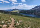
Looking north up Littlerock Creek towards the peaks atop the Beartooth Pass.

Enjoying a scenic resting spot at the head of Losekamp Lake, with Sawtooth Mountain visible in the distance.

From the foot of Gardner Lake, the Gardner Headwall--a popular summer backcountry ski area visible to the left.

Beartooth Loop - view from near the trailhead on the Beartooth Highway - 7-19-18. Photo by Jim Walla.
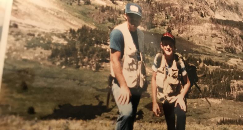
Mike C. and my young son, Shawn C. standing at 10,500 ft over-looking Hell Roaring lakes back in 1985. Photo by Tiffany Cucciardi Schenk.

https://www.stateparks.com/beartooth_loop_national_recreation_trail_in_wyoming.html. Photo by Wyoming State Parks.
Location: Shoshone National Forest, Rocky Mountain Park
- States: Wyoming
The Beartooth Loop Trail is a scenic loop trail that originates near the Gardner headwall, a well-known geologic feature adjacent to the Beartooth All-American Highway. This trail traverses a scenic piece of the alpine and sub-alpine Beartooth Plateau. After a relatively steep plunge from the Highway to Gardner Lake, the trail follows a relatively gentle grade in a large loop. In addition to stunning scenery, the trail takes users in close proximity to three large lakes noted for small but hungry fish. The fauna of the area includes pike, marmots, mule deer, raptors, and occasionally a grizzly bear or wolf which inhabit the wilds adjacent to the trail. The trail serves as a compliment to the scenic Beartooth All-American road which traverses the Plateau and on to Yellowstone National Park.
Accessibility Information
No text provided.
Allowed Uses:
Bicycling Dogs, on leash Equestrian Motorized vehicles, motorcycling Motorized vehicles, snowmobiling Snow, cross-country skiingOther Activities
- Camping
- Fishing
- Snow, snow play general
- Wildlife viewing / observation
Public Contact
Trampus BarhaugShoshone National Forest
Cody, WY 82414
[email protected] • (307) 754-7207
www.fs.fed.us/r2/shoshone
Contact the trail manager for current maps and visiting details.
More Details
- Elevation (low): 8900
- Elevation (high): 10530
- Elevation (cumulative): --
- Part of a Trail System? No
- National Designations: National Millenium
- Surface (primary): Soil
- Surfaces (additional): Soil
- Tread Width (average): 18"
- Tread Width (minimum): --
- Running length (minimum): --
- Tread Grade (average, percent): 10
- Tread Grade (maximum): 30
- Running length (maximum): --
- Cross-slope (average, percent): --
- Cross-slope (maximum): --
- Running length (maximum): --
- Certified as an NRT
Nov 15, 1979