Bethel Spring Recreational Preserve Trail System
check with the trail manager for updated details before visiting.
Bethel Spring Recreational Preserve Trail System
Nonprofit
Backcountry Trail
- Length
1.8 miles
- Elevation Gain
--
- Route Type
out & back
- Length
1.8 miles - Elevation Gain
-- - Route Type
out & back
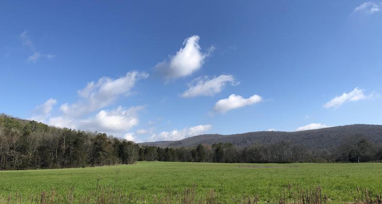
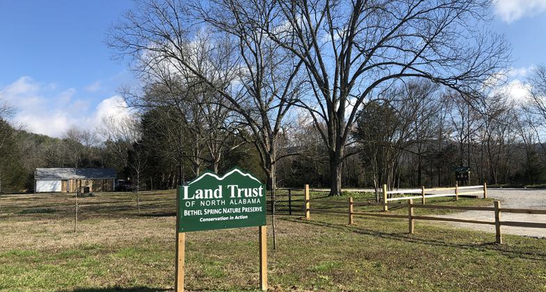
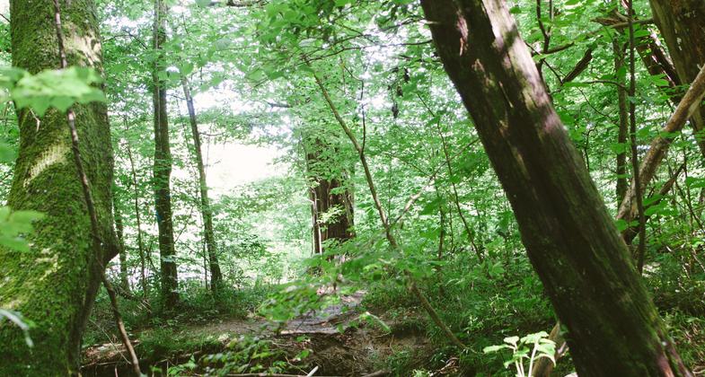
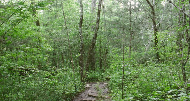
Bethel Spring Nature Preserve, owned and managed by Land Trust of North Alabama, is a 360 acre property on Keel Mountain with 200 acres open to the public for outdoor recreation. The preserve currently offers hikers a little under two miles of free trails to explore from dawn to dusk daily, including upland forest, working farmland, historic sites, an environmentally-significant spring and creek, as well as one of Madison County's largest waterfalls.
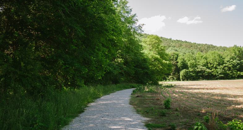
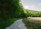
Trail borders field with mountain view. Photo by Christina Byrne
Photo
Photo
Photo
Photo
Photo
Photo
Location: Located on the south side of Keel Mountain approximately 20 minutes from the City of Huntsville, Alabama and approximately 2 miles from the Paint Rock River.
- States: Alabama
- Cities/Townships: New Hope
Bethel Spring Nature Preserve, owned and managed by Land Trust of North Alabama, is a 360-acre property on Keel Mountain with 200 acres open to the public for outdoor recreation. The preserve currently offers hikers a little under two miles of free trails to explore from dawn to dusk daily, including upland forest, working farmland, historic sites, an environmentally-significant spring, and a creek, as well as one of Madison County's largest waterfalls.
This preserve is possible because of two sisters who generously donated their land that belonged to their family for over 132 years. The property is noted in historical accounts as a picturesque landscape and popular space for community gatherings. Both sisters knew they wanted to preserve the mountain, farm, and magnificent natural features just as they were. In 2014, the Land Trust took over as future stewards of this special place. The preserve's trailhead and parking area are located adjacent to the sisters' former home site.
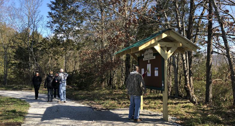
Beginning from the trailhead, Bethel Loop Trail - a .3-mile crushed gravel loop - welcomes hikers to the trail system and makes natural exploration accessible to visitors of varying abilities. This flat, easy stroll passes alongside working farmland and crosses Bethel Creek twice before returning to the parking area. The loop trail and trailhead parking area were constructed in 2019 through a partnership with Madison County Commission" District 3 with grant funding from the Alpha Foundation. This trail provides an opportunity for many people to access the benefits offered by nature who would otherwise be unable to participate.
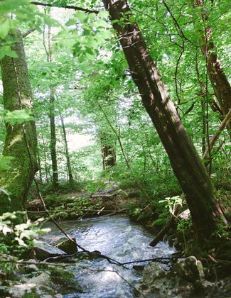
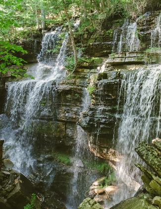
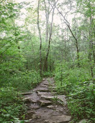
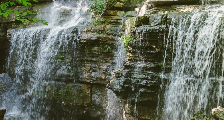
The remaining 1.3 miles in the Bethel Spring trail system are made up of three trails that create a loop, winding up and back down the side of Keel Mountain. The destination feature of this hike is a spectacular waterfall, estimated to be 35-55 feet tall and 50-75 feet wide and possibly the tallest in Madison County. The falls, while impressive enough above ground and continues it's descent into a cave below "known as Paul's Cave. Paul's Cave is one of three known to exist on the property and is listed on the Alabama Cave Survey as 1,338 feet in length and 334 feet in depth. Due to safety concerns and the vulnerability of these unique ecosystems, caves on all Land Trust nature preserves are not open to the public without a permit acquired through the National Speleological Society.
Water from the falls flows through the cave then downhill underground and exits through a spring at the base of the mountain. The spring feeds Bethel Creek, generating an ideal habitat for a variety of aquatic species. The Land Trust is currently working with local biologists to identify fish and muscles found in the spring and creek.
Bethel Spring's pristine natural land provides habitat and a reliable water source for native wildlife. The property also serves as an important potential roosting habitat for federally-endangered Indiana and Northern Long-Eared Bats. There is two major hibernaculum for these species found within five miles. Because of the property's unique natural features, abundant wildlife, and agricultural uses, it will serve as a frequent venue for the Land Trust's environmental education programs offered to the public throughout the year.
Land Trust trails are maintained by staff with lots of volunteer support. Regular trail care work days are held at least twice a month at Land Trust nature preserves. The location for these work days is determined based on need. Visitors, volunteers, and staff report trail problems and the Land Manager prioritizes projects and allocates resources to address them. Preserve rules are posted on trailhead kiosks to provide information such as opening hours (dawn to dusk), permitted and prohibited uses (i.e. no motorized vehicles, no bikes 24 hours after rainfall, no hunting, camping, etc.), behaviors expected of all visitors (i.e. leave no trace, stay on marked trails, no trail modifications, etc.). Seasonal tips are also posted on trailhead kiosks which include recommendations to encourage visitors to use caution and enjoy trails in a responsible way (examples: bring a buddy/map/water, be aware of seasonal hazards ticks, snakes, etc.). Visitors are instructed to notify local law enforcement if they encounter suspicious activity. The Land Trust also maintains relationships with preserve neighbors who help monitor activity on the property and in some cases, these partners also handle regular maintenance tasks such as mowing, trail building/maintenance, and litter cleanup in coordination with Land Trust staff. Local groups, businesses, and individuals can adopt trails through out Trail Care Partners program in order to provide additional maintenance and monitoring. All trails are well marked and a trail map is provided on the trailhead kiosk but can also be downloaded from landtrustnal.org.
Accessibility Information
No text provided.
Allowed Uses:
Bicycling Dogs, on leash Hiking/WalkingOther Activities
- Caving
- Heritage and history
- Wildlife viewing / observation
Public Contact
Andy PrewettLand Trust of North Alabama
2707 Artie St SW Suite 6
Huntsville, AL 35805
[email protected] • 256-534-5263
Contact the trail manager for current maps and visiting details.
More Details
- Elevation (low): 617
- Elevation (high): 1430
- Elevation (cumulative): --
- Part of a Trail System? No
- Surface (primary): Soil
- Surfaces (additional): Boardwalk, Rock, boulders, Rock, crushed, Rock, smooth
- Tread Width (average): 24"
- Tread Width (minimum): 18
- Running length (minimum): --
- Tread Grade (average, percent): 4
- Tread Grade (maximum): 15
- Running length (maximum): --
- Cross-slope (average, percent): 0
- Cross-slope (maximum): --
- Running length (maximum): --
- Certified as an NRT
Jun 3, 2021