Big Creek Trail System
check with the trail manager for updated details before visiting.
Big Creek Trail System
USDA Forest Service
Backcountry Trail
- Length
15.6 miles
- Elevation Gain
--
- Route Type
out & back
- Length
15.6 miles - Elevation Gain
-- - Route Type
out & back
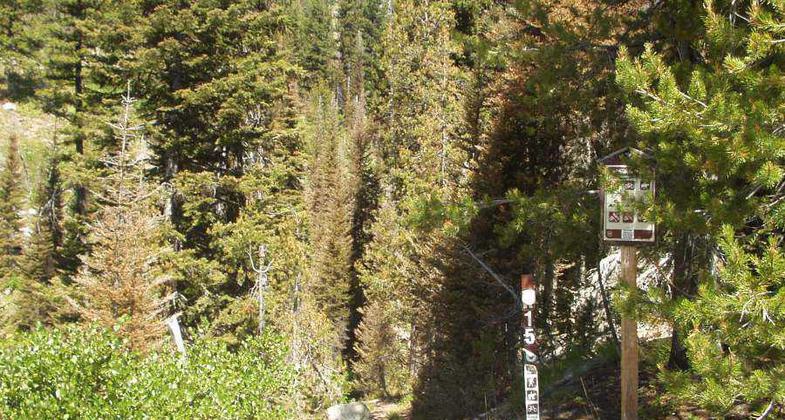
Location: Big Creek, ID, S of I-90 at Kellogg, access by Forest Rds 50, 537, and 1907.
- States: Idaho
- Counties: Shoshone
This area is bounded by private lands on the west, Coeur d'Alene Divide on the north, Cemetery Ridge Road on the east, and the St. Joe River on the south. It provides an example of multiple-use recreation. It is enjoyed by hikers, stock users, motorcyclists, and ATV riders. Elevations range from 2400 feet to over 6000 feet with over six prominent peaks. The topography is steep and dissected. The area is one of the closest and earliest places to open up and lose its snow for people to recreate. Many people plan their Memorial Day weekends here. The 1910 Fire consumed nearly the entire area. The vegetation is a mosaic of extensive brush fields, remnant stands of older trees, and 100-year-old lodgepole pine stands. The Big Creek area was railroad-logged following the 1910 Fire but evidence of this is essentially unnoticeable. Developments include cabins, lookout remnants, and signs of mining activity. Big game hunting is very popular here and Big Creek supports important fisheries.
Accessibility Information
No text provided.
Allowed Uses:
Bicycling Dogs, on leash Equestrian Hiking/Walking Motorized vehicles, motorcyclingOther Activities
- Camping
Public Contact
D. LaneUS Forest Service
HC Box 1
Avery, ID 83802
(208) 245-4547
Contact the trail manager for current maps and visiting details.
More Details
- Elevation (low): 2400
- Elevation (high): 4800
- Elevation (cumulative): --
- Part of a Trail System? No
- Surface (primary): Soil
- Surfaces (additional): Soil
- Tread Width (average): 18"
- Tread Width (minimum): --
- Running length (minimum): --
- Tread Grade (average, percent): 8
- Tread Grade (maximum): 20
- Running length (maximum): --
- Cross-slope (average, percent): --
- Cross-slope (maximum): --
- Running length (maximum): --
- Certified as an NRT
Oct 17, 1979