Bird to Gird Pathway / Indian to Girdwood Trail
check with the trail manager for updated details before visiting.
Bird to Gird Pathway / Indian to Girdwood Trail
State
Backcountry Trail
Rail Trail
- Length
13 miles
- Elevation Gain
--
- Route Type
out & back
- Length
13 miles - Elevation Gain
-- - Route Type
out & back
Mountains, glaciers, beluga whales, and ocean views are a few of the spectacular sights you can take in on the Girdwood to Indian Pathway.

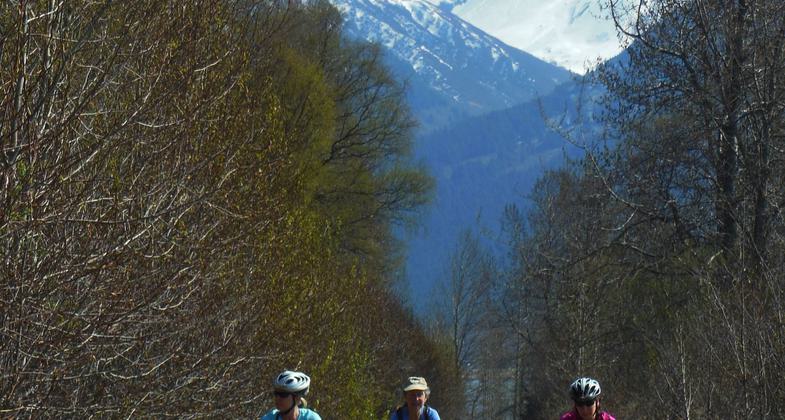
Bicyclists enoying spring sunshine on the Bird-to-Gird Trail near Anchorage. Photo by Susan Sommer.


Bicyclists enoying spring sunshine on the Bird-to-Gird Trail near Anchorage. Photo by Susan Sommer.
Location: Mile 90 to Mile 103 Seward Highway, Just up above Seward Hwy, connecting Girdwood to Indian, overlooking Turnagain Arm.
- States: Alaska
- Counties: Anchorage
Known to locals as the 'Bird to Gird' this trail was recently enlarged to include an extra six miles to Indian. The now thirteen-mile pathway follows the Turnagain Arm next to the nationally designated Scenic Seward Highway. Most of the trail was built on the old highway alignment when the highway was moved close to the ocean. Interpretive signs of geologic features, wildlife, and avalanche mitigation line the trail. Three communities Girdwood, Bird, and Indian are connected by this trail for the benefit of the residents. Trails leave the path and access each of the communities' own valley trails. The trail passes through the birch and spruce-filled Bird Creek campground allowing trail users to stop and spend the night if needed. Parts of the trail are groomed for cross-country skiing in the winter by Alaska State Park Rangers. Bikers, hikers, dog walkers, skate skiers, and rollerblades as well as many others enjoy the use of the trail.
Accessibility Information
No text provided.
Allowed Uses:
Bicycling Dogs, on leash Hiking/WalkingOther Activities
- Camping
- Fishing
Public Contact
Alaska State ParksMile 115 Seward Highway
anchorage, AK 99501
[email protected] • (907) 269-8400
www.dnr.state.ak.us/park
Contact the trail manager for current maps and visiting details.
More Details
- Elevation (low): 60
- Elevation (high): 150
- Elevation (cumulative): --
- Part of a Trail System? No
- Surface (primary): Paved
- Surfaces (additional): Paved
- Tread Width (average): 127"
- Tread Width (minimum): --
- Running length (minimum): --
- Tread Grade (average, percent): 5
- Tread Grade (maximum): 12
- Running length (maximum): --
- Cross-slope (average, percent): --
- Cross-slope (maximum): --
- Running length (maximum): --
- Certified as an NRT
May 31, 2006


