Buckeye Trail
check with the trail manager for updated details before visiting.
Buckeye Trail
U.S. Corps of Engineers
Backcountry Trail
- Length
0.4 miles
- Elevation Gain
--
- Route Type
out & back
- Length
0.4 miles - Elevation Gain
-- - Route Type
out & back
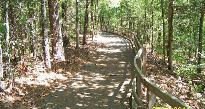
The 660-foot long Buckeye Trail was constructed in conjuction with the Mossy Bluff Trail to provide a quality trail experience for persons who are not physically able to negotiate the more difficult areas.
Location: Greers Ferry Lake, 3 miles north of Herber Springs.
- States: Arkansas
- Counties: Cleburne
The 660-foot-long Buckeye Trail was constructed in conjunction with the Mossy Bluff Trail to provide a quality trail experience for persons who are not physically able to negotiate the more difficult areas. The trail is accessible to wheelchairs and its smooth, level surface is easy to walk. Two picnic tables enable those who use this trail to enjoy a meal under the forest canopy. Two vista points provide lofty views of the area downstream of the Greers Ferry Lake Dam.
Accessibility Information
No text provided.
Allowed Uses:
Swimming Dogs, on leashOther Activities
- Camping
Public Contact
Jeff Price PriceUS Army Corps of Engineers
P.O. Box 1088
Herber Springs, AR 72543
[email protected] • (501) 362-2416
Contact the trail manager for current maps and visiting details.
More Details
- Elevation (low): 475
- Elevation (high): 495
- Elevation (cumulative): --
- Part of a Trail System? No
- Surface (primary): Paved
- Surfaces (additional): Paved
- Tread Width (average): 48"
- Tread Width (minimum): --
- Running length (minimum): --
- Tread Grade (average, percent): --
- Tread Grade (maximum):
- Running length (maximum): --
- Cross-slope (average, percent): --
- Cross-slope (maximum): --
- Running length (maximum): --
- Certified as an NRT
Mar 7, 1978


