Burnside Park Nature Trail
check with the trail manager for updated details before visiting.
Burnside Park Nature Trail
City, Town, or County
Backcountry Trail
- Length
2 miles
- Elevation Gain
--
- Route Type
out & back
(1 review)
- Length
2 miles - Elevation Gain
-- - Route Type
out & back
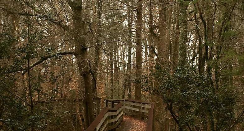
The nature trail is a nice walk through the woods. Photo by Mississippi Sought.
The nature trail is a nice walk through the woods. Photo by Mississippi Sought.

Location: At Burnside Lake Water Park, 5 miles north of Philadelphia.
- States: Mississippi
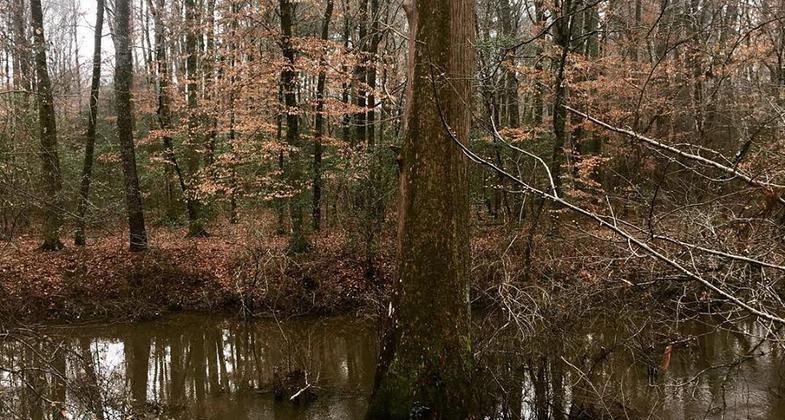
Burnside Lake Water Park consists of 115 acres in Neshoba County approximately five miles northeast of Philadelphia on Highway 15. The park is located on Burnside Lake, an oxbow lake of the Pearl River. The park facilities include: The Park Auditorium that can accommodate meetings of up to 180 people in heated and air conditioned comfort 22 improved campsites with water and electricity, boat ramp, oxbow lake, fishing pier, three open-air pavilions, three lighted ball fields, picnicking areas, playgrounds, nature trail, suspension bridge, bathhouse and comfort stations. Burnside Lake Water Park is operated and maintained by the Philadelphia Neshoba County Park Commission.
Accessibility Information
No text provided.
Reviews
Patricia Ellis
Nice trail, needs some maintenance, but State Park closed?
Burnside State Park is small and, according to what I can find online, no longer considered a state park. The gate was open, so I was able to drive in and look around for the Nature Trail, which was designated as an NRT in 1978 so I wasn’t sure what I would find. I found the trail at the back of the old campground. Nice bridges (one needs repair), a clear path through the woods, and a small swampy area. There are no signs naming this trail or that it was designated as a NRT. The loop length is less than half a mile long, not two miles…unless perhaps the original trail included the campground road walk to the trail, but even then, it’s not two miles. I would give this a four if it was clear to me this area is actually still a state park and had regular upkeep, and five if it was clear the trail had regular maintenance. The bridges (except for one) are solid but don’t look like they have had the leaves brushed off of them in years, and one bridge is damaged but passable with care.
Allowed Uses:
Hiking/WalkingPublic Contact
Parks and Recreation CommissionRoute 6
Philadelphia, MS 39350
Contact the trail manager for current maps and visiting details.
More Details
- Elevation (low): --
- Elevation (high): --
- Elevation (cumulative): --
- Part of a Trail System? No
- Surface (primary): --
- Surfaces (additional): --
- Tread Width (average): 0"
- Tread Width (minimum): --
- Running length (minimum): --
- Tread Grade (average, percent): --
- Tread Grade (maximum):
- Running length (maximum): --
- Cross-slope (average, percent): --
- Cross-slope (maximum): --
- Running length (maximum): --
- Certified as an NRT
Apr 3, 1978