Canaan Valley Institute Trail System
check with the trail manager for updated details before visiting.
Canaan Valley Institute Trail System
Nonprofit
Backcountry Trail
- Length
6.5 miles
- Elevation Gain
--
- Route Type
Loop
- Length
6.5 miles - Elevation Gain
-- - Route Type
Loop
The 6.5 mile trail offers a safe and easily accessible option for users from the adjacent town of Davis, WV, for short hikes, dog-walking, bird watching, berry picking and bicycling. The trail system has been used as part of the West Virginia State Mountain Bike Championship Race course, and will be connected to the Heart of the Highlands Trail system.

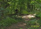
Climbing out of Canaan; https://www.singletracks.com/photo.php?p=30779. Photo by Outdoornut.
Location: Davis, WV
- States: West Virginia
- Counties: Tucker
Since work began on the Canaan Valley Institute Trail System in 2005, trails have evolved from a 4-mile discontinuous collection of highly eroded and unsustainable paths to a 6.5-mile system of maintained, multiuse trails.
Sustainable trail-building techniques endorsed by the USDA Forest Service, Appalachian Mountain Club, and the International Mountain Bicycling Association have been utilized to develop new trails and to reclaim and connect severely degraded sections. The Trail System has been strategically planned and constructed to allow eventual connections to adjacent landholder properties including Canaan Valley National Wildlife Refuge, public lands within the Monongahela National Forest, private Vandalia Heritage Foundation properties, and the regionally significant Heart of the Highlands Trail, and Allegheny Highlands Trail. Planning, construction, and maintenance work has largely been accomplished by volunteer labor using recycled and donated materials, on-site building materials, and other resources. This has allowed construction and improvements to be completed at approximately 50% less than the original cost estimated per mile.
Local businesses and trail advocate groups have been part of the planning process and have promoted and encouraged the use of the trail for competitive trail events and by the visiting public from the surrounding area and other geographic regions of the country. Additionally, the trail offers a safe and easily accessible option for users from the adjacent town of Davis, WV, for short hikes, dog-walking, and bicycling, encouraging the overall health of the community. Notable and beneficial partnerships have also formed with the educational community. Several field trips have been conducted by local school classes on the system. A local alternative school has volunteered 1,000 hours in two years to build or repair the trails.
Trails have also been planned to provide exposure to fragile high-elevation wetlands, streams, meadows, and upland forests without causing damage to these features. Certain trail sections use an old wagon road that passes near a historic farm site, both built around 1900 and associated with the logging history of the area.
Additional routes and improvements are planned for the future that encourages connectivity, community involvement, and appropriate utilization of the trail's natural, cultural, and historic assets.
Accessibility Information
No text provided.
Allowed Uses:
Bicycling Dogs, off leash Dogs, on leash Equestrian Hiking/Walking Snow, cross-country skiingOther Activities
- Camping
- Snow, snow play general
- Wildlife viewing / observation
Public Contact
Ken DzaackCanaan Valley Institute
PO Box 673
Davis, WV 26260
[email protected] • (304) 463-4739
www.canaanvi.org
Contact the trail manager for current maps and visiting details.
More Details
- Elevation (low): 3100
- Elevation (high): 3200
- Elevation (cumulative): --
- Part of a Trail System? No
- Surface (primary): Soil
- Surfaces (additional): Boardwalk, Grass or Vegetation, Rock, boulders, Rock, crushed, Soil
- Tread Width (average): 18"
- Tread Width (minimum): --
- Running length (minimum): --
- Tread Grade (average, percent): 5
- Tread Grade (maximum): 10
- Running length (maximum): --
- Cross-slope (average, percent): --
- Cross-slope (maximum): --
- Running length (maximum): --
- Certified as an NRT
n/a

