Canyon Trail
check with the trail manager for updated details before visiting.
Canyon Trail
U.S. Fish and Wildlife Service
Backcountry Trail
- Length
2.2 miles
- Elevation Gain
--
- Route Type
out & back
- Length
2.2 miles - Elevation Gain
-- - Route Type
out & back
Located in Bosque del Apache National Wildlife Refuge, this 2.2-mile interpretive trail offers school groups and visitors year-round the ability to study tracks in the shifting sands, evidence of kangaroo rats, box turtles, and a host of other wildlife that call the refuge home.

Trailhead. Photo by Pam Riches.

Looking over the Refuge from the ridge. Photo by Pam Riches.

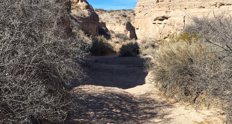
In the canyon. Photo by Pam Riches.
Location: At Bosque del Apache National Wildlife Refuge south of Socorro, NM
- States: New Mexico
- Counties: Socorro
This trail is located on the northern edge of the Chihuahuan Desert in New Mexico and accesses the Indian Well Wilderness Area of the Bosque del Apache NWR.
Here you can search for stories in the tracks; beetles, kangaroo rats, lizards, snakes, and box turtles leave stories in the shifting sands. Follow them to see what the critter was up to. Tracks of geological forces can be observed in the preserved sand dunes and water-deposited rock formations. Birds and bats roost and nest in the canyon walls. Ancient pack rat nests show layers of feast and famine. Rock wrens line the entrance to their nests with pebbles. Junipers and black grama grass remnants left over from a cooler, wetter time grow on the northern slopes while creosote bushes are encroaching on the hotter southern slopes. This trail is used by refuge staff for interpretive programs to school groups and is open year-round to refuge visitors.
Accessibility Information
No text provided.
Allowed Uses:
Hiking/WalkingOther Activities
- Wildlife viewing / observation
Public Contact
Bosque del Apache National Wildlife Refuge1001 NM-1
San Antonio, NM 87832
(575) 835-1828
www.fws.gov/refuge/Bosque_del_Apache
Contact the trail manager for current maps and visiting details.
More Details
- Elevation (low): 4570
- Elevation (high): 4825
- Elevation (cumulative): --
- Part of a Trail System? No
- Surface (primary): Soil
- Surfaces (additional): --
- Tread Width (average): 24"
- Tread Width (minimum): --
- Running length (minimum): --
- Tread Grade (average, percent): 4
- Tread Grade (maximum): 33
- Running length (maximum): --
- Cross-slope (average, percent): --
- Cross-slope (maximum): --
- Running length (maximum): --
- Certified as an NRT
May 31, 2008


