Central Canal Towpath
This information is a public record of the 2002 NRT application and may be out of date if it has not been updated by a trail manager --
check with the trail manager for updated details before visiting.
check with the trail manager for updated details before visiting.
Central Canal Towpath
City, Town, or County
Frontcountry Trail
Urban Trail
- Length
5.23 miles
- Elevation Gain
--
- Route Type
out & back
- Length
5.23 miles - Elevation Gain
-- - Route Type
out & back
Location: Indianapolis
- States: Indiana
- Counties: Marion
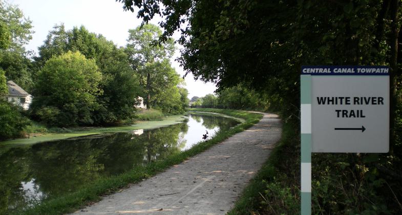
The Central Canal Towpath begins at the Monon Rail Trail in Broad Ripple and follows a historic 1836 canal towpath. The historic character of the canal was maintained by recreating the crushed limestone surface and adding two historic bridges dating to 1872 and 1879 for trail users. The Central Canal Towpath today represents one of a handful of historic functioning canals. The canal was designated as an American Water Landmark in 1971, and it became part of the Indianapolis Greenways System in 1994.
Accessibility Information
No text provided.
Allowed Uses:
Bicycling Dogs, on leash Hiking/Walking Snow, cross-country skiing Snow, snowshoeingOther Activities
- Snow, snow play general
- Wildlife viewing / observation
Public Contact
Terri VanZantIndianapolis Parks, Greenways
900 E. 64th St.
Indianapolis, IN 46220
[email protected] • (317) 327-7431
Contact the trail manager for current maps and visiting details.
More Details
- Elevation (low): 704
- Elevation (high): 728
- Elevation (cumulative): --
- Part of a Trail System? No
- Surface (primary): Rock, crushed
- Surfaces (additional): Rock, crushed
- Tread Width (average): 96"
- Tread Width (minimum): --
- Running length (minimum): --
- Tread Grade (average, percent): 1
- Tread Grade (maximum): 2
- Running length (maximum): --
- Cross-slope (average, percent): --
- Cross-slope (maximum): --
- Running length (maximum): --
- Certified as an NRT
May 30, 2002


