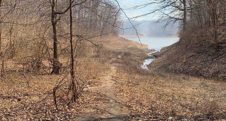
Chief Illini Trail
This information is a public record of the 1990 NRT application and may be out of date if it has not been updated by a trail manager --
check with the trail manager for updated details before visiting.
check with the trail manager for updated details before visiting.
Chief Illini Trail
U.S. Corps of Engineers
Backcountry Trail
- Length
11 miles
- Elevation Gain
--
- Route Type
out & back
- Length
11 miles - Elevation Gain
-- - Route Type
out & back
The Chief Illini Trail is an 11-mile scenic journey along the western edge of Lake Shelbyville.
Location: Trail runs from Lone Point Recreation Area to Eagle Creek State Park, following the west shores of Lake Shelbyville.
- States: Illinois
- Counties: Shelby
This point-to-point trail winds across rolling hills and open prairies offering close-up views of the lake. You may begin the trail at either Lone Point Recreation Area or Eagle Creek State Park. White blazes, post markings, and mile markers make this intermediate-level trail easy to follow.
Maps of the Illini Trail as well as other trails at Lake Shelbyville can be located at http://www.tinyurl.com/lakeshe...
Accessibility Information
No text provided.
Allowed Uses:
Hiking/WalkingPublic Contact
Philip ManhartUS Army Corps of Engineers
Lake Shelbyville
Shelbyville, IL 62565
[email protected] • (217) 774-3951
www.tinyurl.com/lakeshelbyville
Contact the trail manager for current maps and visiting details.
More Details
- Elevation (low): 606
- Elevation (high): 695
- Elevation (cumulative): --
- Part of a Trail System? No
- National Designations: National Millenium
- Surface (primary): Soil
- Surfaces (additional): --
- Tread Width (average): 24"
- Tread Width (minimum): --
- Running length (minimum): --
- Tread Grade (average, percent): 34
- Tread Grade (maximum): 58
- Running length (maximum): --
- Cross-slope (average, percent): --
- Cross-slope (maximum): --
- Running length (maximum): --
- Certified as an NRT
Jul 1, 1990


