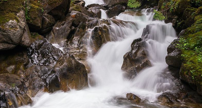
Deception Falls Nature #1078
This information is a public record of the 1979 NRT application and may be out of date if it has not been updated by a trail manager --
check with the trail manager for updated details before visiting.
check with the trail manager for updated details before visiting.
Deception Falls Nature #1078
USDA Forest Service
Backcountry Trail
- Length
0.6 miles
- Elevation Gain
--
- Route Type
out & back
- Length
0.6 miles - Elevation Gain
-- - Route Type
out & back

We saw the sign for this place and decided to stop and see how far we would have to hike to see the actual falls. Turns out the. Photo by Jonathan Miske.
Location: Six miles east of Skykomish, WA on Hwy 2., 75 mi. east of Everett and Seattle on U.S. Highway 2 at Deception Falls picnic site.
- States: Washington
- Counties: King
This .5 mile loop trail through an old growth forest has viewpoints of the Tye River and Deception Falls. A .1 mile section is paved and barrier free accessible. A sign kiosk at the trailhead interprets the driving of the last spike of the transcontinental Great Northern Railway, which was completed in 1893, and is a part of the Stevens Pass Historic District.
Accessibility Information
No text provided.
Allowed Uses:
Dogs, on leash Hiking/WalkingOther Activities
- Fishing
- Wildlife viewing / observation
Public Contact
Renee DohrnPO Box 305
Skykomish, WA 98288
[email protected] • (360) 677-2421
www.fs.fed.us/r6/mb
Contact the trail manager for current maps and visiting details.
More Details
- Elevation (low): 1800
- Elevation (high): 1900
- Elevation (cumulative): --
- Part of a Trail System? No
- Surface (primary): Rock, crushed
- Surfaces (additional): Rock, crushed
- Tread Width (average): 36"
- Tread Width (minimum): --
- Running length (minimum): --
- Tread Grade (average, percent): 10
- Tread Grade (maximum): 20
- Running length (maximum): --
- Cross-slope (average, percent): --
- Cross-slope (maximum): --
- Running length (maximum): --
- Certified as an NRT
Sep 13, 1979

