Devil's Orchard Trail
check with the trail manager for updated details before visiting.
Devil's Orchard Trail
National Park Service
Backcountry Trail
- Length
0.5 miles
- Elevation Gain
--
- Route Type
Loop
- Length
0.5 miles - Elevation Gain
-- - Route Type
Loop
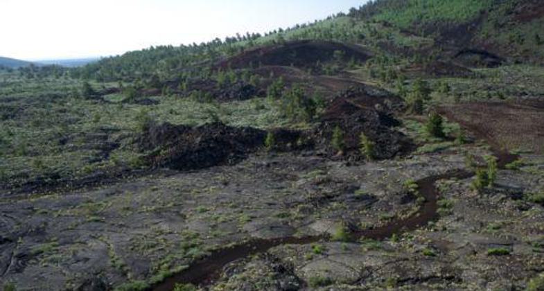
Island-like fragments stand in a sea of cinders on this fully accessible nature trail.
Location: Craters of the Moon National Monument along the Seven-mile Loop Road.
- States: Idaho
- Counties: Butte
About 2000 years ago large chunks of the North Crater cinder cone were broken off and rafted to this spot. Subsequent cinder eruptions and plant growth have transformed the area into a volcanic garden. In springtime, the wildflower displays here are glorious with carpets of dwarf monkeyflowers covering the ground. Early morning or evening visits provide the best opportunities for photography and wildlife observation.
The trail through this area is as unusual as its name. Rather than identify objects the exhibits here challenge you to think about ideas, concerns, and possible solutions.
Accessibility Information
No text provided.
Allowed Uses:
Hiking/WalkingOther Activities
- Heritage and history
- Wildlife viewing / observation
Public Contact
Ted StoutCraters of the Moon National Monument
P.O. Box 29
Arco, ID 83213
[email protected] • (208) 527-1335
www.nps.gov/crmo
Contact the trail manager for current maps and visiting details.
More Details
- Elevation (low): 5742
- Elevation (high): 5745
- Elevation (cumulative): --
- Part of a Trail System? No
- Surface (primary): Paved
- Surfaces (additional): --
- Tread Width (average): 60"
- Tread Width (minimum): 60
- Running length (minimum): --
- Tread Grade (average, percent): 2
- Tread Grade (maximum): 15
- Running length (maximum): --
- Cross-slope (average, percent): 3
- Cross-slope (maximum): --
- Running length (maximum): --
- Certified as an NRT
Jan 13, 1994


