Donner Camp
check with the trail manager for updated details before visiting.
Donner Camp
USDA Forest Service
Backcountry Trail
- Length
0.4 miles
- Elevation Gain
--
- Route Type
out & back
- Length
0.4 miles - Elevation Gain
-- - Route Type
out & back
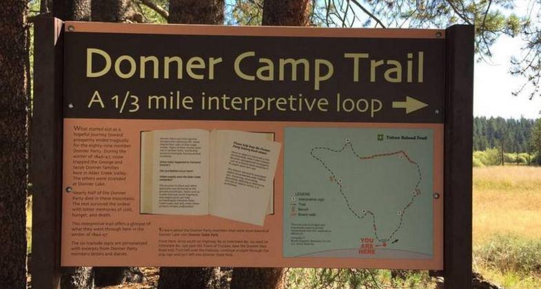
This easy 1/3 mile interpretive trail offers a glimpse of what the Donner Party went through here in the winter of 1846-47

Emigrant-Donner Camp Historical Marker. Photo by Ken Lund/wiki.

Emigrant-Donner Camp Historical Marker. Photo by Ken Lund/wiki.
Location: In Tahoe National Forest, 3 miles N of Truckee at Donner Camp Picnic Area.
- States: California
- Counties: Nevada
This easy 1/3 mile interpretive trail offers a glimpse of what the Donner Party went through here in the winter of 1846-47. Six trailside signs are personalized with excerpts from Donner Party members' letters and diaries. What started out as a hopeful journey toward prosperity ended tragically for the 89-member Donner Party. During the winter of 1846-47, snow trapped the George and Jacob Donner families here in Alder Creek Valley. Others were stranded six miles to the southwest at Donner Lake. Nearly half of the Donner Party died in these mountains. The rest survived the ordeal with bitter memories of cold, hunger, and death.
Accessibility Information
No text provided.
Allowed Uses:
Hiking/WalkingPublic Contact
Tahoe National ForestP.O. Box 6003
Nevada City, CA 95959
Contact the trail manager for current maps and visiting details.
More Details
- Elevation (low): --
- Elevation (high): --
- Elevation (cumulative): --
- Part of a Trail System? No
- Surface (primary): --
- Surfaces (additional): --
- Tread Width (average): 0"
- Tread Width (minimum): --
- Running length (minimum): --
- Tread Grade (average, percent): --
- Tread Grade (maximum):
- Running length (maximum): --
- Cross-slope (average, percent): --
- Cross-slope (maximum): --
- Running length (maximum): --
- Certified as an NRT
Dec 12, 1979

