Doug Ghee Accessible Trail (Bald Rock Boardwalk)
check with the trail manager for updated details before visiting.
Doug Ghee Accessible Trail (Bald Rock Boardwalk)
State
Backcountry Trail
- Length
0.3 miles
- Elevation Gain
--
- Route Type
out & back
- Length
0.3 miles - Elevation Gain
-- - Route Type
out & back
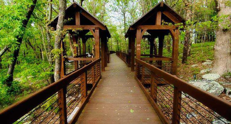
Journey through the enchanted hardwood forested foothills of the Appalachian Mountains. Interpretive signs along the ADA accessible boardwalk unfold the history, culture, and natural history of Cheaha Mountain. This unique boardwalk invites all guests to embrace the natural wonder and beauty at the Bald Rock Overlook located at the end of the boardwalk.
Location: In Cheaha State Park near Delta, AL
- States: Alabama
- Counties: Cleburne
- Cities/Townships: Cheaha State Park
Journey through the enchanted hardwood forested foothills of the Appalachian Mountains. Interpretive signs along the ADA-accessible boardwalk unfold the history, culture, and natural history of Cheaha Mountain. This unique boardwalk invites all guests to embrace the natural wonder and beauty at the Bald Rock Overlook located at the end of the boardwalk.
Cheaha State Park was created in 1933 by the Civilian Conservation Corps (CCC). The CCC surveyed Cheaha Mountain for areas of natural beauty to showcase to the public. They felt that the overwhelming view from Bald Rock was so breathtaking it needed to be accessible to park guests. A 0.6-mile loop path was created to access Bald Rock Overlook.
The original dirt trail connects to the Pinhoti High Point Spur Trail. With 140 miles, the Pinhoti is one of Alabama's longest trails. It starts at Flagg Mountain in Weogufka, AL crosses through Cheaha State Park and the Talladega National Forest into Georgia. It connects to the Benton MacKaye Trail, which leads into the Appalachian Trail. The Pinhoti is the gateway to Alabama's backcountry.
As Alabama's oldest park, Cheaha State Park is dedicated to honoring the spirit of the CCC. Senator Doug Ghee initiated the next chapter of the Bald Rock Overlook trail in 1999 by securing funds to create the 0.3-mile boardwalk to Bald Rock.
This boardwalk, on the highest mountain in Alabama, utilized by over 57,000 park visitors annually, is ADA accessible with a typical grade of 1.1%. Numerous covered alcoves along the boardwalk encourage guests to rest and reflect. Access points also line the boardwalk so guests can step down onto the original trail and explore the forest floor. The purpose of public land is to preserve wildlife, and their habitat, and provide access to green spaces for all citizens. The Doug Ghee Accessible Trail bridges the gap for limited mobility users to experience a wild mountain vista.
Cheaha is a sky island encompassing 2,799 acres. This state park is not only nestled in the foothills of the Appalachian Mountains but also surrounded by 392,567 acres of Talladega National Forest. A sky island is an area separated not by sea but by elevation. Due to the elevation and conservation efforts of Cheaha State Park, as well as the Talladega National Forest, many rare habitats of wild animals and plants are present and protected. As guests enjoy the view from Bald Rock Overlook they will see a living mosaic of longleaf pines surrounded by vibrant hardwoods. The rolling green ridges are home to numerous rare and endangered species such as golden eagles, Indiana bats, spotted skunks, red-cockaded woodpeckers, the Diana fritillary, flame azalea, and Georgia aster among others.
The purpose of a trail is not only to access a destination but also to provide a greater connection to nature. Education provides one of the greatest connections and adventures of all. This trail is utilized by the Park Naturalist to provide over 50 programs annually that include topics such as ecology, nature journaling, nature art, botany, ornithology, wellness programs, and history.
Over 50% of our population resides in urban environments, yet exposure to nature increases overall health. The boardwalk allows everyone from various backgrounds and differing limitations, or skill sets, to access the mountains of Alabama. It allows them to feel the same soft swirling wind on which birds soar. It lets them soak in the scenic view of hundreds of miles. It reminds them to connect to the fires that forged this mountain long ago. It gives them the opportunity to feel wild, free, and to reconnect to the natural world.
For 20 years the Anniston Museum of Natural History and Jacksonville State University Field Schools utilized this trail to provide accessible and interpretive hiking programs of youth nature camps. These provided environmental education for over 2000 students ages 6-12 years. Girl Scouts, Scouts BSA, and numerous field trips from local schools including Alabama Institute for the Deaf and Blind utilize the boardwalk for interpretive hikes.
This trail is completely contained within Cheaha State Park, which is managed by the Alabama Department of Conservation and Natural Resources. This trail is secured by the Park Ranger and considered a safe place for recreation because it is subject to the Alabama State Park Rules and Regulations.
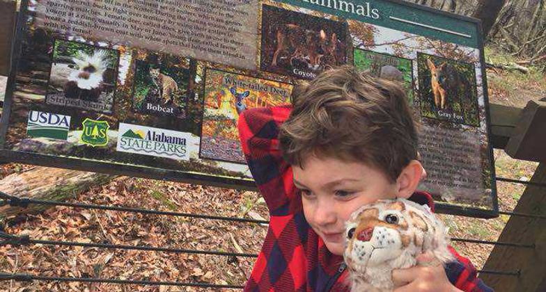
Cheaha State Park partnered with Jacksonville State University and the Talladega National Forest (through a USFS Multicultural Advisory Committee Challenge Grant) to produce 16 educational and interpretive signs that line the boardwalk. The signs cover a broad range of topics from Native American history, CCC history, geology, plants, animals, the water cycle, the carbon cycle, forest succession, fire management, natural wonders, and many more. As guests walk the boardwalk, they are also traveling through history and discovering the natural past of Cheaha Mountain.
Cheaha State Park and trail guests believe what John Muir experienced when he wrote, "Thousands of tired, nerve-shaken, over-civilized people are beginning to find out that going to the mountains is going home; that wildness is a necessity; and that mountain parks and reservations are useful not only as fountains of timber and irrigating rivers but as fountains of life."
Accessibility Information
No text provided.
Allowed Uses:
Dogs, on leash Hiking/WalkingOther Activities
- Heritage and history
- Wildlife viewing / observation
Public Contact
Mandy PearsonAlabama State Parks
2141 Bunker Loop
Delta, AL 36258
[email protected] • 2564129938
Contact the trail manager for current maps and visiting details.
More Details
- Elevation (low): --
- Elevation (high): --
- Elevation (cumulative): --
- Part of a Trail System? No
- Surface (primary): Boardwalk
- Surfaces (additional): Boardwalk
- Tread Width (average): 72"
- Tread Width (minimum): 72
- Running length (minimum): --
- Tread Grade (average, percent): 3
- Tread Grade (maximum):
- Running length (maximum): --
- Cross-slope (average, percent): 1
- Cross-slope (maximum): --
- Running length (maximum): --
- Certified as an NRT
Oct 22, 2020


