Elephant Rocks State Park Braille Trail
check with the trail manager for updated details before visiting.
Elephant Rocks State Park Braille Trail
State
Backcountry Trail
Urban Trail
- Length
1.2 miles
- Elevation Gain
--
- Route Type
Loop
(3 reviews)
- Length
1.2 miles - Elevation Gain
-- - Route Type
Loop
Paved Braille Signage Trail around the 7.5-acre geologic natural area and spur trail to the ruin of railroad engine house. 20 plus educational signs are on the trail written in both English and Braille. Repaved in 2010, most of the trail is at least 4 feet wide and wheelchair accessible. One 3-foot section is still only 36 inches wide.

The trail is fully paved and gently meanders past scenic and historic points of interest. Photo by Donna Kridelbaugh & John Stone.

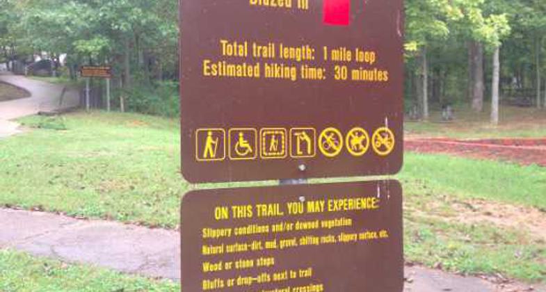
Trailhead sign with information. Photo by Donna Kridelbaugh & John Stone.

Overlook of an old quarry pond from the "Missouri Red" granite-mining days. Photo by Donna Kridelbaugh & John Stone.

Trailhead sign with regulations. Photo by Donna Kridelbaugh & John Stone.

Overlooks provide panoramic views of the Ozark Plateau landscape. Photo by Donna Kridelbaugh & John Stone.

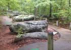
A mound of the park's namesake pink-granite elephant rocks. Photo by Donna Kridelbaugh & John Stone.

The Braille Trail at Elephant Rocks State Park. Photo by Fiana Shapiro.

Sample interpretative sign with braille welcoming visitors to the park. Photo by Donna Kridelbaugh & John Stone.

Location: Inside Elephant Rocks State Park - 7406 Hwy 21, Belleview, MO 63623 N37°39.045 W90°41.415
- States: Missouri
- Counties: Iron
Paved Braille Signage Trail around the 7.5-acre geologic natural area and spur trail to the ruin of railroad engine house. 20 plus educational signs are on the trail written in both English and Braille. Repaved in 2010, most of the trail is at least four feet wide and wheelchair accessible. One three-foot section is still only 36 inches wide.
At Elephant Rocks State Park, giant boulders of 1.5 billion-year-old granite stand end-to-end like a train of circus elephants. Visitors to Elephant Rocks State Park can easily view the granite boulders from the one-mile paved Braille Trail. Designed especially for people with visual and physical disabilities, the Braille Trail is the first of its kind in Missouri state parks, possibly in the entire state. The path through the site is asphalt and has varying slopes and conditions. In addition, this trail offers interpretive stations with Braille text. Carpet patches followed by hand-rope mark stations and changes in the pathway. Most of the one-mile-long trail is shady and rest areas are provided.
A trail spur brings visitors to a point overlooking an old quarry site. Just outside the park is the oldest recorded commercial granite quarry in the state. This quarry, opened in 1869, furnished facing stone for bridge piers across the Mississippi River, and from 1880 to 1900, millions of paving blocks for the St. Louis levee and downtown streets came from this quarry. Other nearby quarries supplied granite for many major St. Louis buildings.
In addition to the mammoth granite boulders, the trail also passes by an old quarry pond, which now supports a variety of animal life. A short spur off of the trail takes visitors to the top of the granite outcrop, where they can further explore the maze of giant elephant rocks. Thirty picnic sites among the giant red boulders provide ample opportunity for family picnicking and exploration of the elephant rocks. One individual and one group picnic site, located among the trees, have been modified with pavement and extended-end tables.
Accessibility Information
No text provided.
Reviews
Escape to Braille
My first, the paths are not really easy for a vehicle.
Robert Sigafoos
Elephant Rocks
I live around the area and I am familiar with the trails, Iove the trails and think it serves a great historical purpose to Missouri. The park there is great to wind out the children's energy and the trail is great for exercise. Although you can swim or fish there the pond is a great site mixed with the woods and granite.
Donna Kridelbaugh & John Stone
A walk among the gentle, granite giants
The Braille Trail at Elephant Rocks State Park is an easy, 1.2-mile paved loop trail that meanders around giant pink-granite boulder fields and historic mining remains. The trail features interpretive signs with braille at several scenic and historic points along the trail, including an overlook to an old quarry pond. A short staircase from the trail ascends to a mound of pink-granite boulders, where you can wander among these stoic giants and take in panoramic views of the Ozark Plateau landscape. These pink-granite formations also are designated as a state natural area, and, thus, protected for future generations to enjoy. From the back side of the loop, there is a short spur trail (part of the Engine Ruins Trail), which is paved and leads to the ruins of an old engine house from the granite-mining days in the early 1900s. At the trailhead, there are several picnic tables and restroom facilities for visitors to use. While on the trail, please remember to leave no trace by packing out your trash and treading carefully on the rocks to ensure an enjoyable outdoor experience for everyone.
Allowed Uses:
Dogs, on leash Hiking/WalkingOther Activities
- Wildlife viewing / observation
Public Contact
Mo. DNR - Division of State ParksFort Davidson State Historic Site
Pilot Knob, MO 63663
[email protected] • (800) 334-6946
mostateparks.com/park/elephant-rocks-state-park
Contact the trail manager for current maps and visiting details.
More Details
- Elevation (low): --
- Elevation (high): --
- Elevation (cumulative): --
- Part of a Trail System? No
- Surface (primary): Paved
- Surfaces (additional): Paved
- Tread Width (average): 48"
- Tread Width (minimum): 36
- Running length (minimum): --
- Tread Grade (average, percent): --
- Tread Grade (maximum):
- Running length (maximum): --
- Cross-slope (average, percent): --
- Cross-slope (maximum): --
- Running length (maximum): --
- Certified as an NRT
Sep 27, 1973


