Elkhorn Crest
check with the trail manager for updated details before visiting.
Elkhorn Crest
USDA Forest Service
Backcountry Trail
- Length
23 miles
- Elevation Gain
--
- Route Type
out & back
- Length
23 miles - Elevation Gain
-- - Route Type
out & back
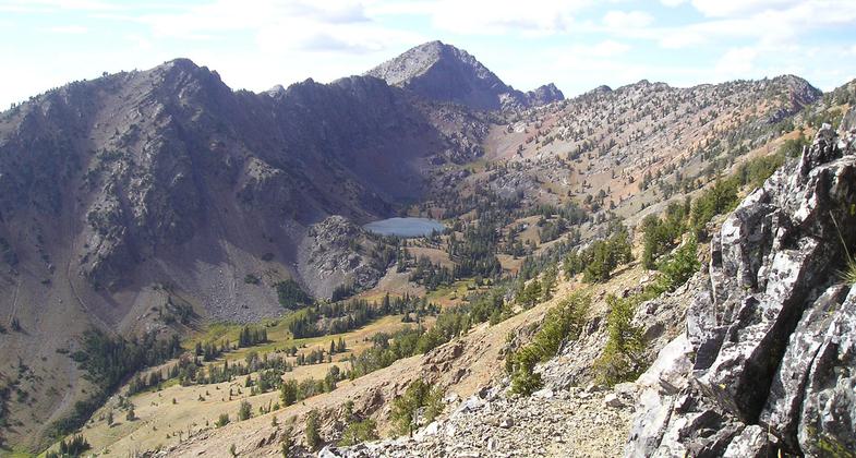
The Elkhorn Crest Trail is the highest trail in the Blue Mountains, crossing alpine and sub-alpine life zones up to 8,200' elevation.

HIgh mountain Twin Lakes in distance along the rugged Elkhorn Crest Trail. Photo by USDA Forest Service.
Location: West of Baker City, OR., Crosses Blue Mtns. NW of Baker City.
- States: Oregon
- Counties: Baker, Grant
The Elkhorn Crest Trail is the highest trail in the Blue Mountains, crossing alpine and sub-alpine life zones up to 8,200' elevation.
Panoramic views of the Baker Valley and the Wallowa Mountains meet the eye to the east, while the endless folds of the Blue Mountains fade away to the south and west. Six lakes may be viewed from the Crest Trail and an additional five can be reached by spur trails or cross-country travel. Meadows and some springs below the trail offer rest stops and campsites. Wildlife such as deer, elk, mountain goats, and birds of prey may be observed from the trail.
The southern section of the trail is located in general forest lands while the northern end is within the Baldy Unit of the North Fork John Day Wilderness Area.
Accessibility Information
No text provided.
Allowed Uses:
Bicycling Dogs, on leash Hiking/Walking Motorized vehicles, motorcycling Motorized vehicles, snowmobilingOther Activities
- Camping
- Fishing
- Snow, snow play general
Public Contact
Wallowa-Whitman National ForestBaker Ranger District
Baker City, OR 97814
(541) 523-6391
www.fs.usda.gov/recmain/wallowa-whitman/recreation
Contact the trail manager for current maps and visiting details.
More Details
- Elevation (low): 7100
- Elevation (high): 8400
- Elevation (cumulative): --
- Part of a Trail System? No
- Surface (primary): Soil
- Surfaces (additional): Soil
- Tread Width (average): 24"
- Tread Width (minimum): --
- Running length (minimum): --
- Tread Grade (average, percent): 5
- Tread Grade (maximum): 10
- Running length (maximum): --
- Cross-slope (average, percent): --
- Cross-slope (maximum): --
- Running length (maximum): --
- Certified as an NRT
Oct 4, 1979

