English Point Trail
This information is a public record of the 1980 NRT application and may be out of date if it has not been updated by a trail manager --
check with the trail manager for updated details before visiting.
check with the trail manager for updated details before visiting.
English Point Trail
USDA Forest Service
Backcountry Trail
Urban Trail
- Length
6 miles
- Elevation Gain
--
- Route Type
out & back
- Length
6 miles - Elevation Gain
-- - Route Type
out & back

English Point on near Hayden Lake. Photo courtesy of https://naughtyhiker.wordpress.com/.

Photo courtesy of the Naughty Hiker. https://naughtyhiker.wordpress.com.
Location: Fernan Ranger District, In Coeur d'Alene National Forest, NE of Coeur d'Alene above Hayden Lake.
- States: Idaho
- Counties: Kootenai
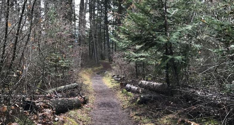
The trail is a heavily used urban trail. The surface is compacted gravel and soil, there are 10 wooded benches, an amphitheater, a viewing platform, and five loops of varying lengths. The trail has been designed for multiple uses and divided into user areas. One area is designated for equestrian use and another for hikers only. The trail is also open in the winter for cross-country skiing and snowshoeing. Thanks to a 2019 Eagle Scout project, the trail now has 14 benches, an amphitheater, and a picnic table.
Accessibility Information
No text provided.
Allowed Uses:
Bicycling Hiking/Walking Snow, cross-country skiing Snow, snowshoeingOther Activities
- Snow, snow play general
Public Contact
M. Jason SmithUS Forest Service
Fernan Ranger District
Coeur d'Alene, ID 83814
(208) 664-2318
Contact the trail manager for current maps and visiting details.
More Details
- Elevation (low): 2055
- Elevation (high): 2569
- Elevation (cumulative): --
- Part of a Trail System? No
- National Designations: National Millennium
- Surface (primary): Soil
- Surfaces (additional): Rock, crushed
- Tread Width (average): 48"
- Tread Width (minimum): --
- Running length (minimum): --
- Tread Grade (average, percent): 5
- Tread Grade (maximum): 8
- Running length (maximum): --
- Cross-slope (average, percent): --
- Cross-slope (maximum): --
- Running length (maximum): --
- Certified as an NRT
Jun 12, 1980


