Fall Creek Falls Trail
check with the trail manager for updated details before visiting.
Fall Creek Falls Trail
USDA Forest Service
Backcountry Trail
- Length
0.9 miles
- Elevation Gain
--
- Route Type
out & back
- Length
0.9 miles - Elevation Gain
-- - Route Type
out & back
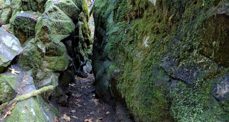
Fall Creek Falls Trail is within the Wild & Scenic North Umpqua River Corridor. The trail passes through a narrow bedrock crevice and lush mature coniferous forest to double falls with tiers of 35 and 50 feet.
Location: W of Steamboat on SR 138 at Fall Creek Recreation Site.
- States: Oregon
- Counties: Douglas
Fall Creek Falls Trail is within the Wild & Scenic North Umpqua River Corridor. The trail passes through a narrow bedrock crevice and lush mature coniferous forest to double falls with tiers of 35 and 50 feet.
The one-mile Fall Creek Falls National Recreation Trail leads to a multi-tiered waterfall with the two largest tiers measuring 35 and 50 feet. The trail passes through a narrow crevice in a large boulder, then climbs alongside the creek through old-growth Douglas-fir. After a short hike, the trail reaches the base of the falls, where you can view the largest, bottommost tier tumbling over a mossy rock cliff. The trail then continues more steeply to a viewing platform where you can view the second to the last tier, before climbing to connect with the old North Umpqua Highway, Road 4710. From this vantage point, you can view the top of the falls descending into the gorge you just climbed through.
Accessibility Information
No text provided.
Allowed Uses:
Hiking/WalkingPublic Contact
Steve AndersonUS Forest Service
P.O. Box 1008
Roseburg, OR 97470
[email protected] • (541) 496-3532
Contact the trail manager for current maps and visiting details.
More Details
- Elevation (low): 1300
- Elevation (high): 1400
- Elevation (cumulative): --
- Part of a Trail System? No
- National Designations: National Millenium
- Surface (primary): Soil
- Surfaces (additional): Soil
- Tread Width (average): 24"
- Tread Width (minimum): --
- Running length (minimum): --
- Tread Grade (average, percent): --
- Tread Grade (maximum): 12
- Running length (maximum): --
- Cross-slope (average, percent): --
- Cross-slope (maximum): --
- Running length (maximum): --
- Certified as an NRT
Dec 7, 1978


