Fall Creek Trail
check with the trail manager for updated details before visiting.
Fall Creek Trail
USDA Forest Service
Backcountry Trail
- Length
13.7 miles
- Elevation Gain
--
- Route Type
out & back
(2 reviews)
- Length
13.7 miles - Elevation Gain
-- - Route Type
out & back
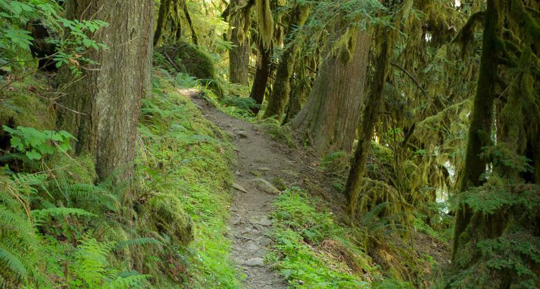
*Currently Closed* As a Hiker Only route, it follows Fall Creek for most of the route, allowing the hiker to enjoy the cool valley air and observing the mix of riparian (streamside) vegetation.
Location: North of Dexter Reservoir, about 15 miles west of the town of Lowell and approx. 45 minutes from Eugene
- States: Oregon
- Counties: Lane
Note: The Fall Creek NRT is currently closed due to storm damage from February 2019.
As a Hiker Only route, it follows Fall Creek for most of the route, allowing the hiker to enjoy the cool valley air and observe the mix of riparian (streamside) vegetation. Just east of Bedrock Campground, the trail climbs upslope around a parcel of private land and then descends to Fall Creek.
The route is generally level with log footbridges for crossing streams. There are many scenic views of Fall Creek and side streams. Before reaching Bedrock Campground, Slick Creek is crossed on a bridge where there is a small cave and rock outcrops. Many good fishing, swimming, picnicking, and camping spots are found along the trail. Above the Forest Road 1828 crossing, the trail used to cross Fall Creek on a 90-foot-long log bridge. The segment of the trail from this crossing to Forest Road 1833 provides many scenic views of Fall Creek.
Accessibility Information
No text provided.
Reviews
Fred
Neglected and forgotten
After sustaining heavy damage in an ice storm five years ago this trail has been abandoned, The signs are down. Trash and graffiti abound. A once beautiful and loved trail has been lost to budget cuts and apathy.
Great Trail!
Swimming holes with clear water and lush forest, this trail is a summer favorite.
Allowed Uses:
Hiking/WalkingPublic Contact
Middle Fork Ranger District60 South Pioneer St.
Lowell, OR 97452
(541) 937-2129
Contact the trail manager for current maps and visiting details.
More Details
- Elevation (low): 950
- Elevation (high): 1400
- Elevation (cumulative): --
- Part of a Trail System? No
- Surface (primary): Soil
- Surfaces (additional): Soil
- Tread Width (average): 24"
- Tread Width (minimum): --
- Running length (minimum): --
- Tread Grade (average, percent): 7
- Tread Grade (maximum): 20
- Running length (maximum): --
- Cross-slope (average, percent): --
- Cross-slope (maximum): --
- Running length (maximum): --
- Certified as an NRT
Feb 6, 1979


