First Landing State Park Trails System
This information is a public record of the 1977 NRT application and may be out of date if it has not been updated by a trail manager --
check with the trail manager for updated details before visiting.
check with the trail manager for updated details before visiting.
First Landing State Park Trails System
State
Backcountry Trail
- Length
23 miles
- Elevation Gain
--
- Route Type
out & back
- Length
23 miles - Elevation Gain
-- - Route Type
out & back

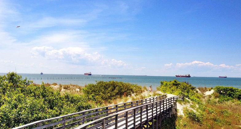
First Landing State Park looking towards Chesapeake Bay entrance. Photo by David Broad.

Photo by Virginia State Parks.

First Landing State Park. Photo by Virginia State Parks.

Exploring the park. Photo by Virginia State Parks Staff.
Location: In Virginia Beach at First Landing State Park (formerly Seashore State Park)
- States: Virginia
With the exception of the Chesapeake Bay beach, the trail system traverses most of the habitats found in First Landing State Park are cypress swamps, salt marsh, maritime forest, freshwater wetlands, dunes, and bay shoreline. A single First Landing trail allows bicycles, the Cape Henry Trail, which runs right through the park and is 5.9 miles long.
Accessibility Information
No text provided.
Allowed Uses:
Hiking/WalkingPublic Contact
Department of Conservation and ParksFirst Landing State Park
Richmond, VA 23219
Contact the trail manager for current maps and visiting details.
More Details
- Elevation (low): --
- Elevation (high): --
- Elevation (cumulative): --
- Part of a Trail System? No
- Surface (primary): Soil
- Surfaces (additional): --
- Tread Width (average): 0"
- Tread Width (minimum): --
- Running length (minimum): --
- Tread Grade (average, percent): --
- Tread Grade (maximum):
- Running length (maximum): --
- Cross-slope (average, percent): --
- Cross-slope (maximum): --
- Running length (maximum): --
- Certified as an NRT
Apr 13, 1977

