Fish Creek Falls Trail #1102
This information is a public record of the 1979 NRT application and may be out of date if it has not been updated by a trail manager --
check with the trail manager for updated details before visiting.
check with the trail manager for updated details before visiting.
Fish Creek Falls Trail #1102
USDA Forest Service
Backcountry Trail
Urban Trail
- Length
6 miles
- Elevation Gain
--
- Route Type
out & back
- Length
6 miles - Elevation Gain
-- - Route Type
out & back

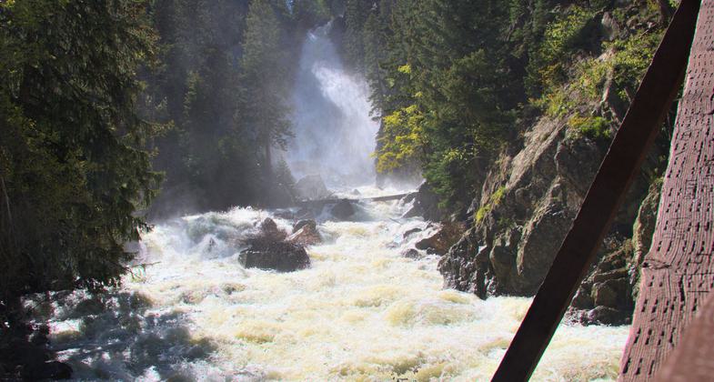
Fish Creek Falls, near Steamboat Springs. Photo by Kimon Berlin.

Fish Creek Falls, near Steamboat Springs. Photo by Kimon Berlin.
Location: Beginning: T6N, R84W, Section 14; Ending: T6N, R83W, Section 24, in Routt NF E of Steamboat Springs, joins Fish Creek Falls Rd. to Continental Divide and Base Camp.
- States: Colorado
- Counties: Routt
Fish Creek Falls Trailhead #1102 is located in the Steamboat Springs Area and managed by the Hahns Peak/Bears Ears Ranger District. Enjoy a great view of the waterfalls from a wheelchair accessible overlook trail or a dirt trail that can take you down to the base of the falls, and a historical bridge, which crosses Fish Creek and continues the trail 5 miles to Long Lake and connects to the 1101,1032. The area is open year-round, providing snowshoeing and ice climbing in the winter months.
Accessibility Information
No text provided.
Allowed Uses:
Bicycling Boating, motorizedPublic Contact
US Forest Service925 Weiss Drive
Steamboat Springs, CO 80487
[email protected] • (970) 879-1870
www.fs.fed.us/r2/mbr
Contact the trail manager for current maps and visiting details.
More Details
- Elevation (low): 7300
- Elevation (high): 10500
- Elevation (cumulative): --
- Part of a Trail System? No
- Surface (primary): Rock, crushed
- Surfaces (additional): Rock, boulders, Rock, crushed, Snow or ice, Soil
- Tread Width (average): 24"
- Tread Width (minimum): --
- Running length (minimum): --
- Tread Grade (average, percent): 10
- Tread Grade (maximum): 30
- Running length (maximum): --
- Cross-slope (average, percent): --
- Cross-slope (maximum): --
- Running length (maximum): --
- Certified as an NRT
Dec 12, 1979

