Fish Lake Trail
check with the trail manager for updated details before visiting.
Fish Lake Trail
USDA Forest Service
Backcountry Trail
- Length
8 miles
- Elevation Gain
--
- Route Type
out & back
- Length
8 miles - Elevation Gain
-- - Route Type
out & back
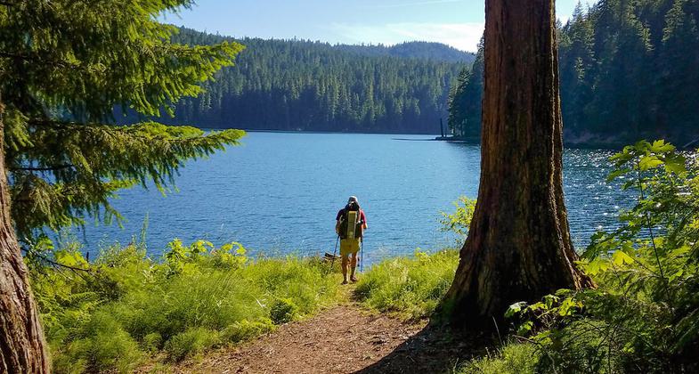
Fish Lake Trail #1570 leads to Fish Lake, the largest and deepest lake in the Rogue-Umpqua Divide Wilderness.
Location: Umpqua National Forest, 28.6 miles northeast of Tiller, Oregon
- States: Oregon
- Counties: Douglas
This trail follows Fish Lake Creek through a mixed stand of trees, then gradually climbs to Beaver Swamp and enters the Rogue-Umpqua Divide Wilderness. The trail continues past the junction with Beaver Swamp Trail #1569 before encountering Fish Lake. From there it follows the lake's northwest shore, where hikers can view Highrock Mountain and the many rock formations of Rocky Ridge. The trail then continues past the lake, following Highrock Creek through a birch and hardwood forest. The trail passes another junction with Lakes Trail #1578 just before it leaves the creek and enters scattered trees and large meadows typical of the high divide country. Finally, the trail terminates at the junction with the Rogue-Umpqua Divide Trail #1470 with a last look at Highrock Meadows.
Accessibility Information
No text provided.
Allowed Uses:
Equestrian Hiking/WalkingPublic Contact
USDA Forest Service, Tiller Ranger District27812 Tiller Trail Highway
Tiller, OR 97484
(541) 825-3100
Contact the trail manager for current maps and visiting details.
More Details
- Elevation (low): --
- Elevation (high): --
- Elevation (cumulative): --
- Part of a Trail System? No
- Surface (primary): Soil
- Surfaces (additional): --
- Tread Width (average): --"
- Tread Width (minimum): --
- Running length (minimum): --
- Tread Grade (average, percent): --
- Tread Grade (maximum):
- Running length (maximum): --
- Cross-slope (average, percent): --
- Cross-slope (maximum): --
- Running length (maximum): --
- Certified as an NRT
Mar 4, 1981