Flour Sack Battle Trail
check with the trail manager for updated details before visiting.
Flour Sack Battle Trail
State
Frontcountry Trail
- Length
1 mile
- Elevation Gain
--
- Route Type
out & back
- Length
1 mile - Elevation Gain
-- - Route Type
out & back
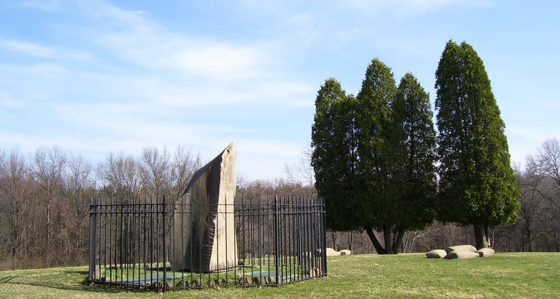
A single slice of Ligonier "Blue Rock" stands as a marker on the spot where Col. Bouquet's force of 450 men retreated. A monument and a flagpole were erected at the site of the flour bag entrenchment on Edge Hill.

Battle of Bushy Run Monument. Photo by By Kevin Myers at en.wikipedia.

Flour Sack Trail sign.
Location: NW of Greensburg and Jeannette, access PA Turnpike exit 6.
- States: Pennsylvania
- Counties: Westmoreland
- Cities/Townships: Jeannette, Penn Township
On August 5, 1763, British Colonel Henry Bouquet and his troops were attacked 25 miles east of Fort Pitt near Edge Hill. In what became known as the Battle of Bushy Run, the troops sustained heavy casualties. Bouquet was able to build a temporary fortification out of the flour sacks carried by his packhorses, and his leadership kept his troops from abandoning the field.
A single slice of Ligonier "Blue Rock" stands as a marker on the spot where Col. Bouquet's force of 450 men retreated. A monument and a flagpole were erected at the site of the flour bag entrenchment on Edge Hill.
Accessibility Information
No text provided.
Allowed Uses:
Hiking/WalkingPublic Contact
Penna. History and Mus. Comm.P.O. Box 1026
Harrisburg, PA 17108
Contact the trail manager for current maps and visiting details.
More Details
- Elevation (low): --
- Elevation (high): --
- Elevation (cumulative): --
- Part of a Trail System? No
- Surface (primary): --
- Surfaces (additional): --
- Tread Width (average): 0"
- Tread Width (minimum): --
- Running length (minimum): --
- Tread Grade (average, percent): --
- Tread Grade (maximum):
- Running length (maximum): --
- Cross-slope (average, percent): --
- Cross-slope (maximum): --
- Running length (maximum): --
- Certified as an NRT
May 31, 1975

