Flume Trail
check with the trail manager for updated details before visiting.
Flume Trail
USDA Forest Service
Backcountry Trail
- Length
11 miles
- Elevation Gain
--
- Route Type
out & back
- Length
11 miles - Elevation Gain
-- - Route Type
out & back

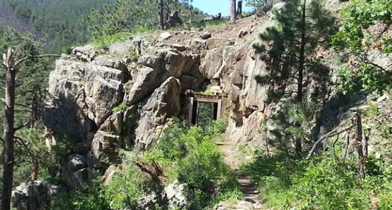
The Flume Trail. Remnants of the mining boom of the 1880s. Photo by Visit Rapid City.

Flume Trail - Black Hills National Forest. Photo by Jonathan Voelz.

Flume Trail - Black Hills National Forest. Photo by Jonathan Voelz.

Flume Trail - Black Hills National Forest. Photo by Jonathan Voelz.

Serpents Trail. Photo by Anonymous.
Location: Sheridan Lake Campground, off US 385 southwest of Rapid City.
- States: South Dakota
- Counties: Pennington
The 11-mile historic Flume Trail takes you back in time to the mining boom of the 1880s. The Rockerville Flume carried water 20 miles, from Spring Creek west of present-day Sheridan Lake, east to the placer diggings near Rockerville. The trail follows the actual flume bed for much of its length. Along the way, you'll see historic artifacts and parts of the flume itself. Because of these fragile artifacts, this is a hiker's only trail.
Special features along the trail include:
* Spring Creek Canyon, a scenic walk-in fishery just below Sheridan Lake Dam
* Two flume tunnels about a half-mile below the dam
* Spring Creek Loop, a three-mile circle route on the north end of the trail
* Boulder Hill, a high rocky vista with spectacular views of the eastern Black Hills, plains, and Badlands.
Accessibility Information
No text provided.
Allowed Uses:
Hiking/WalkingOther Activities
- Camping
- Wildlife viewing / observation
Public Contact
Black Hills National ForestRoute 2
Custer, SD 57730
(605) 673-2251
Contact the trail manager for current maps and visiting details.
More Details
- Elevation (low): --
- Elevation (high): --
- Elevation (cumulative): --
- Part of a Trail System? No
- Surface (primary): --
- Surfaces (additional): --
- Tread Width (average): 0"
- Tread Width (minimum): --
- Running length (minimum): --
- Tread Grade (average, percent): --
- Tread Grade (maximum):
- Running length (maximum): --
- Cross-slope (average, percent): --
- Cross-slope (maximum): --
- Running length (maximum): --
- Certified as an NRT
Dec 12, 1979


