Fontenelle Forest Trail
This information is a public record of the 1971 NRT application and may be out of date if it has not been updated by a trail manager --
check with the trail manager for updated details before visiting.
check with the trail manager for updated details before visiting.
Fontenelle Forest Trail
Nonprofit
Backcountry Trail
- Length
17 miles
- Elevation Gain
--
- Route Type
Loop
- Length
17 miles - Elevation Gain
-- - Route Type
Loop
Location: Suburban Bellevue, NE
- States: Nebraska
- Counties: Sarpy
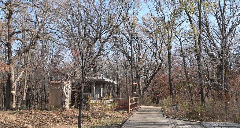
554 acres of wooded hills, hilltop prairies and flood plain forest. Views of River Valley are beautiful. Trails wind through rolling prairies, forests of oak, hickory and basswood. Many different, loop trail options.
Accessibility Information
No text provided.
Allowed Uses:
Hiking/WalkingOther Activities
- Wildlife viewing / observation
Public Contact
Fontenelle Forest Nature Center1111 Bellevue Blvd. N.
Bellevue, NE 68005
(402) 731- 3140
Contact the trail manager for current maps and visiting details.
More Details
- Elevation (low): --
- Elevation (high): --
- Elevation (cumulative): --
- Part of a Trail System? No
- Surface (primary): Rock, crushed
- Surfaces (additional): Boardwalk, Soil
- Tread Width (average): 36"
- Tread Width (minimum): --
- Running length (minimum): --
- Tread Grade (average, percent): --
- Tread Grade (maximum):
- Running length (maximum): --
- Cross-slope (average, percent): --
- Cross-slope (maximum): --
- Running length (maximum): --
- Certified as an NRT
Jun 1, 1971


