Fort Bayard Wood Haul Wagon Road
check with the trail manager for updated details before visiting.
Fort Bayard Wood Haul Wagon Road
USDA Forest Service
- Length
11.5 miles
- Elevation Gain
--
- Route Type
out & back
- Length
11.5 miles - Elevation Gain
-- - Route Type
out & back
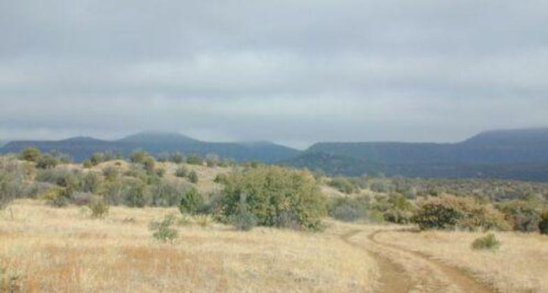
Trail begins at trailhead near Fort Bayard. Another NRT (Sawmill Road Trail) also starts here. The trail crosses through pinion pine-juniper hills and winds its way into ponderosa pine forest near Signal Peak.

Wagon tracks. Photo by USDA Forest Service.

Fort Bayard Trail System sign. Photo by USFS.
Location: Off SR 15 on FS Rd. 536 6 mi. E of Silver City.
- States: New Mexico
The Woodhaul Wagon Trail is part of a historic trail system close to Silver City and runs from the Fort Bayard Administrative Site to the Wagon Wheel Ruts.
The Woodhaul Wagon Ruts are a result of the tireless passing of supply wagons hauling construction and fuel wood from the high pine forests of the Pinos Altos mountain range to the Fort Bayard Military Reservation. Mule and oxen-drawn wagons were used to haul the heavy loads. Over time the hard wagon wheels cut into the volcanic cap rock leaving a testament to the endurance of these early settlers. The route to the Wagon Wheel Ruts follows primitive roads that pass over land that was once part of the reservation for approximately 11 miles and concludes on the Lockney Road (FR885A) about 1.5 miles south of the CDT/Allie Canyon/Lockney Road junction.
The trail begins at the trailhead near Fort Bayard. Another NRT (Sawmill Road Trail) also starts here. The trail crosses through pinion pine-juniper hills and winds its way into a ponderosa pine forest near Signal Peak.
Accessibility Information
No text provided.
Allowed Uses:
Dogs, on leash Hiking/WalkingOther Activities
- Camping
Public Contact
Tom DwyerGila National Forest
3005 Camino del Bosque
Silver City, NM 88061
tdwywer/r3[~][email protected] • (505) 388-8470
Contact the trail manager for current maps and visiting details.
More Details
- Elevation (low): --
- Elevation (high): --
- Elevation (cumulative): --
- Part of a Trail System? No
- Surface (primary): --
- Surfaces (additional): --
- Tread Width (average): 36"
- Tread Width (minimum): --
- Running length (minimum): --
- Tread Grade (average, percent): --
- Tread Grade (maximum):
- Running length (maximum): --
- Cross-slope (average, percent): --
- Cross-slope (maximum): --
- Running length (maximum): --
- Certified as an NRT
Oct 18, 1979

