Fox-Wisconsin Heritage Water Trail
check with the trail manager for updated details before visiting.
Fox-Wisconsin Heritage Water Trail
Nonprofit
Water Trail (other)
- Length
280 miles
- Elevation Gain
--
- Route Type
out & back
- Length
280 miles - Elevation Gain
-- - Route Type
out & back
The Fox-Wisconsin Heritage Water Trail includes the Lower Fox, Upper Fox, and Lower Wisconsin rivers. It slices diagonally across the state for 280 miles (approx 250 recommended for paddling) from Green Bay in the northeast, through the City of Portage, and on to the convergence of the Wisconsin with the Mississippi River in the southwest. The water trail route was selected for its significance as the exploration route of Fr. Jacques Marquette and Louis Joliet. It encompasses 15 counties and more than 40 municipalities. The Fox-Wisconsin Heritage Parkway and National Recreation Trail are defined by a waterway, but also celebrate how two major rivers have shaped Wisconsin's journey through significant historical events, industrial breakthroughs, cultural advances, enjoyment of recreational riches, and environmental recovery.
Location: A 250-mile water trail along the Fox and Wisconsin Rivers in Wisconsin--extending from the City of Green Bay to Portage and ending in Prairie du Chien, which is at the confluence of the Wisconsin and Mississippi Rivers.
- States: Wisconsin
- Counties: Brown, Outagamie, Winnebago
- Cities/Townships: Prairie du Chien: to Portage: to Green Bay: with mutiple cities, villages, and towns in between.
The Fox-Wisconsin Heritage Water Trail (FWHWT), located on the Fox River and Lower Wisconsin River waterway, warrants national recognition as a National River Trail for its critical role in the early discovery and settlement of the central United States and its shaping of life in Wisconsin. The water trail route was selected for its significance as the exploration route of Fr. Jacques Marquette and Louis Joliet.
National Recreation Trail status denotes an important contribution to the national story and ample reason for visitors from in and outside of the state to want to experience it. The designation as a National Water Trail bolsters community pride in the area's history and traditions, and in residents' interest in preserving and interpreting the landscape for future generations. It offers a collaborative approach to conservation without compromising traditional local control.
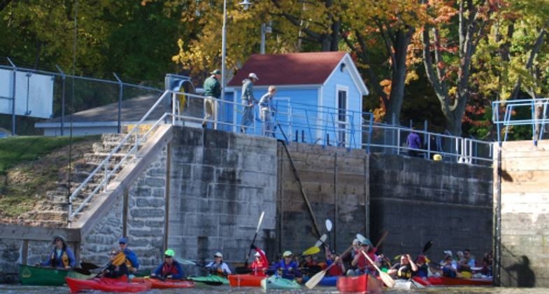
The water trail includes the Lower Fox, Upper Fox, and Lower Wisconsin rivers. It slices diagonally across the state for 280 miles from Green Bay in the northeast, through the City of Portage, and on to the convergence of the Wisconsin with the Mississippi River in the southwest and takes in 15 counties and more than 40 municipalities. Approximately 250 miles of this route is considered suitable for water trail activities and paddling, although the entire route can be paddled if desired. Paddling conditions are generally easy and suitable for beginners with the exception of the Lower Fox, where extreme caution is advised near locks and dams. Paddlers traversing this part of the FWHWT should review water conditions before venturing out. The water trail includes two large lake crossings that can be paddled if desired but are generally avoided due to wind and wave conditions. The two lakes are Lake Winnebago on the Lower Fox River and Lake Wisconsin on the Lower Wisconsin River.
Canoe/kayak landings, as well as portages, have been built to support the water trail around many of the locks and dams. Signage has been installed with more trail signage and kiosks planned. Recently, a grant application was submitted in an effort to build a total of ten ADA-accessible kayak landings. For the past 15 years, local paddling clubs have held public paddles and educational sessions along portions of the proposed water trail, and general interest is increasing. Other affiliated groups such as the organization Greenways are promoting biking and walking trails adjacent to the Water Trail.
It is hoped such efforts from supporters of this project and affiliated parties will lead to responsible and sustainable use that preserves and improves the water trail resource, as well as leads to overall economic vitality.
Accessibility Information
No text provided.
Allowed Uses:
Boating, motorized Boating, human-poweredPublic Contact
None provided
Contact the trail manager for current maps and visiting details.
More Details
- Elevation (low): 581
- Elevation (high): 780
- Elevation (cumulative): --
- Part of a Trail System? No
- National Designations: Pending US Congressional Heritage Parkway Status
- Surface (primary): Water, slow moving
- Surfaces (additional): Water, slow moving, Water, calm
- Tread Width (average): 127"
- Tread Width (minimum): 72
- Running length (minimum): --
- Tread Grade (average, percent): --
- Tread Grade (maximum):
- Running length (maximum): --
- Cross-slope (average, percent): 0
- Cross-slope (maximum): --
- Running length (maximum): --
- Certified as an NRT
May 29, 2013


