Fremont Trail
check with the trail manager for updated details before visiting.
Fremont Trail
USDA Forest Service
Backcountry Trail
- Length
134 miles
- Elevation Gain
--
- Route Type
out & back
- Length
134 miles - Elevation Gain
-- - Route Type
out & back
This trail, also known as the Southern Oregon Intertie Trail, traverses the Fremont National Forest from north to south for 134 miles.

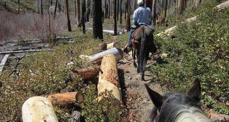
On the Fremont National Recreation Trail #160 in Fremont National Forest, Oregon; photo by Lane & Linda Thomas.

Dylan VanWeelden taking a lap on the Winter Rim section. Photo by Gabriel Tiller.

A volunteer and her helper pause to take in the beauty of the Winter Rim section. Photo by Gabriel Tiller.

Trail opening Silver Creek Marsh west to Antler Trailhead. Photo by Linda Thomas.

Trail opening. Farm Well Trailhead to Hagar Mt. Fire lookout. Photo by Linda Thomas.

Silver Creek Marsh camp-trail clearing. Photo by Linda Thomas and Lane Thomas.

Silver Creek Marsh camp-trail clearing. Photo by Linda Thomas and Lane Thomas.

Silver Creek Marsh camp-trail clearing. Photo by Linda Thomas and Lane Thomas.

Silver Creek Marsh camp-trail clearing. Photo by Linda Thomas and Lane Thomas.
Location: Fremont National Forest, In Fremont National Forest, SW of Summer Lake, parallel to SR 31 W of Paisley.
- States: Oregon
- Counties: Lake
Much of it is along the interface between the high desert of the northwestern Great Basin and the Cascade Mountains. Numerous mountain peaks and distant panoramas are found along the edge of the route. The trail also travels for 30 miles along the edge of a 2000' high fault block on Winter Rim. Open Ponderosa Pine forests and outstanding scenery are found throughout this trail. A six-mile gap in this trail will be finished in 2002.
Accessibility Information
No text provided.
Allowed Uses:
Bicycling Dogs, on leash Equestrian Hiking/WalkingOther Activities
- Camping
- Fishing
Public Contact
Larry HillsFremont National Forest
HC 10, Box 337
Lakeview, OR 97630
[email protected] • (541) 947-6313
www.fs.fed.us/r6/fremon
Contact the trail manager for current maps and visiting details.
More Details
- Elevation (low): 4810
- Elevation (high): 8196
- Elevation (cumulative): --
- Part of a Trail System? No
- Surface (primary): Soil
- Surfaces (additional): Soil
- Tread Width (average): 18"
- Tread Width (minimum): --
- Running length (minimum): --
- Tread Grade (average, percent): 6
- Tread Grade (maximum): 18
- Running length (maximum): --
- Cross-slope (average, percent): --
- Cross-slope (maximum): --
- Running length (maximum): --
- Certified as an NRT
Oct 4, 1979

