Garnet Winter Trail
This information is a public record of the 1984 NRT application and may be out of date if it has not been updated by a trail manager --
check with the trail manager for updated details before visiting.
check with the trail manager for updated details before visiting.
Garnet Winter Trail
Bureau of Land Management
Backcountry Trail
- Length
30.3 miles
- Elevation Gain
--
- Route Type
out & back
- Length
30.3 miles - Elevation Gain
-- - Route Type
out & back
Location: On SR 200 30 mi. E of Missoula near Greenough Post Office.
- States: Montana
- Counties: Missoula
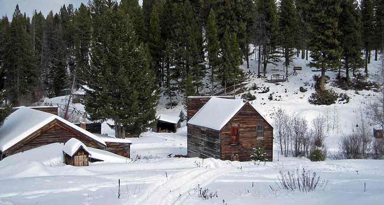
The winter trail is the central component of the 116 Garnet winter trail system. Follows existing roads impassable to wheeled vehicles in snow. Trail climbs 2,000 ft into evergreen forest of mountains, with views of Blackfoot River Valley, Swan Range.
Accessibility Information
No text provided.
Allowed Uses:
Hiking/Walking Motorized vehicles, snowmobiling Snow, cross-country skiing Snow, snowshoeingOther Activities
- Snow, snow play general
Public Contact
Bryan MaioranoBureau of Land Management
Missoula Field Office
Missoula, MT 59804
[email protected] • (406) 329-3735
Contact the trail manager for current maps and visiting details.
More Details
- Elevation (low): --
- Elevation (high): --
- Elevation (cumulative): --
- Part of a Trail System? No
- Surface (primary): Soil
- Surfaces (additional): Snow or ice
- Tread Width (average): 127"
- Tread Width (minimum): --
- Running length (minimum): --
- Tread Grade (average, percent): --
- Tread Grade (maximum):
- Running length (maximum): --
- Cross-slope (average, percent): --
- Cross-slope (maximum): --
- Running length (maximum): --
- Certified as an NRT
May 10, 1984


