Gateway State Trail
check with the trail manager for updated details before visiting.
Gateway State Trail
State
Frontcountry Trail
Rail Trail
- Length
18 miles
- Elevation Gain
--
- Route Type
out & back
- Length
18 miles - Elevation Gain
-- - Route Type
out & back
The 18-mile converted rail-trail runs from urban St. Paul to the nationally significant St. Croix River Valley. It is a good example of a multi-use trail that provides links to a local and regional network of trails, parks, and greenways. In addition to its natural and historic resources, the trail also provides recreational opportunities like biking and horseback riding.

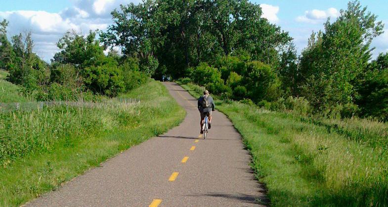
The Gateway State Trail traverses urban open space in the heart of Saint Paul, Mn. Photo by McGhiever.

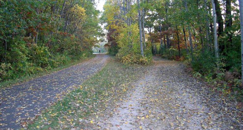
A section of the Gateway State Trail with parallel paved and unpaved trackways. Photo by Akkrenkel.
Location: St. Paul, MN
- States: Minnesota
- Counties: Ramsey, Washington
The Gateway State Trail is an 18-mile trail that runs from St. Paul to Pine Point County Park, MN. This paved trail cuts through a cross-section of urban areas, parks, lakes wetlands, and fields in Ramsey and Washington Counties. It is used year-round by bikers, skaters, walkers, runners, persons in wheelchairs, horseback riders, and skiers. Many trail users are surprised to find these rural landscapes so close to the metro area; while others appreciate the access it provides to downtown St. Paul and the State Capital complex. The Gateway also provides connections to many local and regional trails.
The Gateway Trail is the most heavily used non-motorized state trail in MN. Located on a former Soo Line Railroad grade, the trail is generally level and wheelchair accessible. Along the eastern 10 miles of the Gateway, an adjacent non-asphalt trail is available for horseback riding or carriage driving. Motorized vehicles including snowmobiles, motorized scooters, and motorbikes are not allowed.
Accessibility Information
No text provided.
Allowed Uses:
Bicycling Equestrian Hiking/Walking Snow, cross-country skiing Snow, snowshoeingOther Activities
- Fishing
- Snow, snow play general
Public Contact
Suzann WillhiteMN. Dept. of Natural Resources
Trails & Waterways
St. Paul, MN 55106
[email protected] • (651) 772-7937
www.dnr.state.mn.u
Contact the trail manager for current maps and visiting details.
More Details
- Elevation (low): --
- Elevation (high): --
- Elevation (cumulative): --
- Part of a Trail System? No
- State Designations: Minnesota State Trail
- Surface (primary): Paved
- Surfaces (additional): Rock, crushed
- Tread Width (average): 0"
- Tread Width (minimum): --
- Running length (minimum): --
- Tread Grade (average, percent): --
- Tread Grade (maximum):
- Running length (maximum): --
- Cross-slope (average, percent): --
- Cross-slope (maximum): --
- Running length (maximum): --
- Certified as an NRT
May 31, 2002

