General George Crook
This information is a public record of the 1979 NRT application and may be out of date if it has not been updated by a trail manager --
check with the trail manager for updated details before visiting.
check with the trail manager for updated details before visiting.
General George Crook
USDA Forest Service
Backcountry Trail
- Length
138 miles
- Elevation Gain
--
- Route Type
out & back
- Length
138 miles - Elevation Gain
-- - Route Type
out & back
Trail is an old military supply road. The path is clearly visible in most sections and largely untouched since pioneer days.

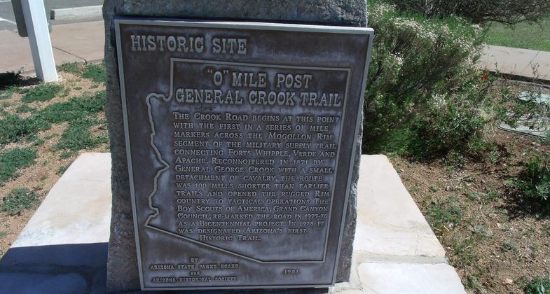
This"0" Mile General Crook Trail Marker is located in the place where in 1871 General George Crook established a military supp. Photo by Tony the Marine.
Location: Follows the Mogollon Rim from W of Clay Springs to Dewey.
- States: Arizona
The Crook Trail is named after General George Crook, the Commander of the Military Department of Arizona in 1871. The General Crook trail is 58.9 miles long. It begins at Coconino National Forest and ends at Cottonwood Trail.
The trail is on an eight-foot-wide old wagon road. Marked with Chevrons(V's) and rock buskers from west Clear Creek to the top of the Rim. Can be hard to find in some places.
Accessibility Information
No text provided.
Allowed Uses:
Dogs, on leash Hiking/WalkingOther Activities
- Camping
Public Contact
Bill StaffordCoconino-Apache Sitgreaves National Forests
Sedona / Beaver Ranger District
Rimrock, AZ 86335
Contact the trail manager for current maps and visiting details.
More Details
- Elevation (low): --
- Elevation (high): --
- Elevation (cumulative): --
- Part of a Trail System? No
- Surface (primary): --
- Surfaces (additional): --
- Tread Width (average): 72"
- Tread Width (minimum): --
- Running length (minimum): --
- Tread Grade (average, percent): --
- Tread Grade (maximum):
- Running length (maximum): --
- Cross-slope (average, percent): --
- Cross-slope (maximum): --
- Running length (maximum): --
- Certified as an NRT
Oct 4, 1979

