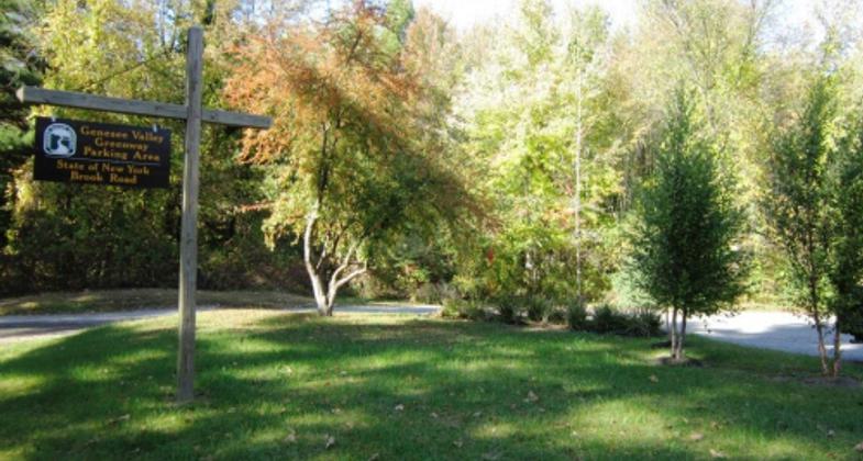
Genesee Valley Greenway State Park Trail
check with the trail manager for updated details before visiting.
Genesee Valley Greenway State Park Trail
State
Backcountry Trail
Frontcountry Trail
Rail Trail
Urban Trail
- Length
84 miles
- Elevation Gain
--
- Route Type
out & back
- Length
84 miles - Elevation Gain
-- - Route Type
out & back
This scenic and historic corridor follows the route of the 19th-century Genesee Valley Canal and the later Genesee Valley Railroad which operated into the second half of the 20th century. As a result, the GVG has a wonderful mix of flat, easily traversed trails that lead users through diverse natural areas, scenic views, and historic attractions.
Location: The Genesee Valley Greenway is located in Western New York and extends 84 miles from the City of Rochester in the north to the Village of Cuba in the south.
- States: New York
- Counties: Monroe, Livingston, Wyoming, Allegany, Cattaraugus
- Cities/Townships: Rochester,Chili,Wheatland,Scottsville,York,Cuylerville, Mount Morris, Portagville,Houghton,Belfast,Rockville,Cuba
As a New York State Park, the Genesee Valley Greenway (GVG) is regularly maintained through a cooperative effort between the Genesee State Park Region and the Allegany State Park Region. Currently (2013) a Management Plan is being developed for the facility utilizing input from the Friends of the Genesee Valley Greenway, neighboring municipalities, adjoining landowners, and the general public.
The Genesee Valley Greenway is an 84-mile public, multi-use trail and natural and historic resource corridor that follows the route of the Genesee Valley Canal (1840-1878) and the Pennsylvania Railroad Rochester Branch (1882-1963/1971) from the Erie Canalway Trail in Rochester's Genesee Valley Park to Hinsdale in Cattaraugus County. It passes through the woodlands, wetlands, river, and stream valleys, rolling farmlands, steep gorges, and historic villages in sixteen towns located in Monroe, Livingston, Wyoming, Allegany, and Cattaraugus counties. Like thousands of other abandoned towpaths and rail beds across the country, the Genesee Valley Greenway provides opportunities for public recreation and an off-road link to communities, parks, and other trails such as the Finger Lakes Trail and Lehigh Valley Trail, and attractions in the region.
The cinders of the former rail bed serve as a level, 12-foot wide trail open for hiking, biking, horseback riding, cross-country skiing, snowshoeing, and snowmobiling. Presently, forty-two miles of the Genesee Valley Greenway State Park are open to the public in Livingston and Monroe counties, thirty-two miles between Rochester and the Livingston County Village of Mt. Morris, and another ten miles in the Livingston County towns of Nunda and Portage.
In the Wyoming County Town of Genesee Falls, approximately 2.5 miles of the former rail bed have served as part of the Finger Lakes Trail (FLT) since 1968. (In 1998, 1.2 miles of this section of FLT and Greenway was also designated North Country National Scenic Trail. On June 26, 1999, this small section of Greenway and FLT also became a National Millennium Trail, by virtue of the North Country National Scenic Trail receiving this distinction.)
In Allegany County, between Belfast and Oramel, 3.1 miles of rail bed are being used as an off-road link between the two communities. Five miles of Greenway have been cleared of brush and trash and are being used by the public in Allegany County between Gleason Hill Road and Route 305 in the Town of Belfast and between Tibbetts Hill Road and South Road in the Town of New Hudson. 1.2 miles of trail are being used between Route 243 and the Route 19 crossing north of Caneadea.
In other locations in Wyoming and Allegany counties, the absence of bridges and culverts and areas of significant erosion, caused by the Genesee River and Black Creek, compromise the integrity of the rail bed and restrict its use. Furthermore, from the Village of Cuba north to .35 miles south of Jackson Hill Road in the Allegany County Town of Cuba, the rail bed has been sold to private landowners.
Greenway development has taken place on the section of the former canal and Pennsylvania rail bed located in Cattaraugus County. Portions of the corridor were previously sold by RG&E to private landowners and to New York State for the construction of Interstate 86, making the creation of a continuous trail to the Town of Hinsdale more difficult. Nevertheless, Hinsdale citizens have cleared Lock #102 and begun to develop a trail along some of the former canal corridor that is privately owned, south of the State-owned section.
As a scenic and aesthetic resource, GVG trail users have cited:
- The canal prism
- The tunnel of green created by the canopy of trees overhanging the trail
- Pastures and farm fields adjoining the trail
- Oak trees among farm fields in Caledonia and Wheatland
- Keshequa Creek gorge and surrounding hills
- Small waterfalls in Sonyea State Forest
- Genesee River Gorge and waterfalls in Letchworth State Park
- Amish farmsteads and farming practices
- Views of the Genesee River
- Beautiful stone structures
Accessibility Information
No text provided.
Allowed Uses:
Bicycling Boating, human-powered Dogs, on leash Equestrian Hiking/Walking Motorized vehicles, snowmobiling Snow, cross-country skiing Snow, snowshoeingOther Activities
- Fishing
- Heritage and history
- Snow, snow play general
- Wildlife viewing / observation
Public Contact
Kristina SchoepferNYS Office of Parks, Recreation, & Historic Pres.
1 Letchworth State Park
Castile, NY 14427
[email protected] • (585) 493-3614
Contact the trail manager for current maps and visiting details.
More Details
- Elevation (low): 500
- Elevation (high): 1500
- Elevation (cumulative): --
- Part of a Trail System? No
- State Designations: State Park
- Surface (primary): Grass or Vegetation
- Surfaces (additional): Paved, Boardwalk, Grass or Vegetation, Rock, crushed, Snow or ice, Soil
- Tread Width (average): 127"
- Tread Width (minimum): 96
- Running length (minimum): --
- Tread Grade (average, percent): --
- Tread Grade (maximum): 7
- Running length (maximum): --
- Cross-slope (average, percent): 0
- Cross-slope (maximum): --
- Running length (maximum): --
- Certified as an NRT
Jun 2, 2014


