George Poston Park Trail System
check with the trail manager for updated details before visiting.
George Poston Park Trail System
City, Town, or County
Backcountry Trail
- Length
10 miles
- Elevation Gain
--
- Route Type
Loop
(3 reviews)
- Length
10 miles - Elevation Gain
-- - Route Type
Loop
The scenic and hilly ten miles of trail also features lush vegetation, fern banks, opportunities for viewing wildlife, and spectacular rare big leaf magnolias all at the base of Spencer Mountain. Spencer Mountain is a 1250 outer-lying monadnock of the Appalachian Mountains.
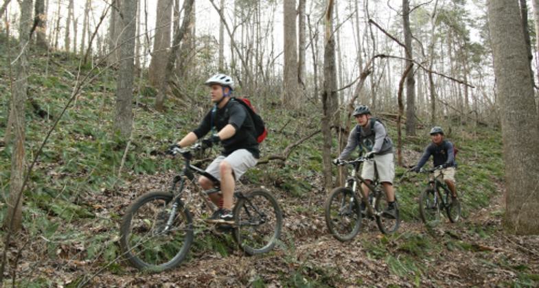
Fern Bank Ride. Photo by Calvin Stiles

Mountain Bikers
Runners Lake Loop

Fresh single track

Bike Trail Jump
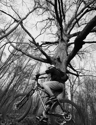
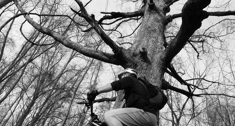
Big Oak Bike Rider

Race for RARE Bridge Runners
Location: George Poston Park, Gastonia NC
- States: North Carolina
- Counties: Gaston
- Cities/Townships: Gastonia, NC
The trails at George Poston Park are a collaborative effort between Gaston County Parks and Recreation and the Piedmont Area Singletrack Alliance (PASA). The trail features tight technical climbs and quick descents with beautiful runs along natural creeks, rock gardens, and thick woods. The trail was built primarily for mountain biking but has become a popular destination for runners, hikers, dog walkers, and nature enthusiasts.
The land for the 344-acre George Poston Park was a gift to Gaston County from George and Edith Poston in 1987. Mr. Poston used the property for recreational purposes and wanted to see the land preserved as naturally as possible. The first phase of the park, featuring eight athletic fields and a horseshoe complex opened to the public in 2001. The park's Master Plan also included trails, picnic areas, a lake, playgrounds, and a park office. In 2005, representatives from Piedmont Area Singletrack Alliance (PASA) requested approval from Gaston County to build mountain bike trails at Poston Park. Park officials and PASA created a Memorandum of Understanding for the trail building and maintenance and construction began in 2006. The entire mountain bike trail was constructed only with hand tools. PASA volunteers include certified trail builders, trained in the latest environmentally sustainable trail building and maintenance techniques. Since beginning construction in 2006, trail construction is ongoing with ten miles of trail on the ground and another 5 miles of future trail planned. To date, volunteers have logged more than 5000 hours building and maintaining trails. Annually, Gaston County Parks and Recreation and PASA renew the MOU agreement that defines the responsibilities of each party. PASA is responsible for trail building and routine maintenance and Gaston County provides funding for capital improvements including bridges, parking, and restrooms. This unique public-private partnership has benefited both trail users and the citizens of Gaston County who have access to this world-class facility with minimal public dollars invested in the project.
The Poston trail system offers opportunities for bikers, hikers, and runners of all levels. The trails provide the only mountain biking trails in Gaston County. Trail parking is located at the lake parking lot and a large kiosk with the trail map is adjacent to the parking lot. The trail map shows the various loops in different colors which correspond to trail blazes on each loop. The stacked loop trail system begins just a few feet from the kiosk and the Kid's Bike Trail is across the parking lot. PASA members and their children built the Kid's Trail in 2013 and it offers beginners a feel for the Poston woods with a flat trail and short mileage. The stacked loop system begins with the Lake Loop which features users' views of the park's lake and wildlife with minimal hills. The Lake Loop crosses two very narrow bridges with scenic views of the two feeder creeks that fill Poston's Lake. The Lake Loop connects to the Laurel Hill Loop which by design is a bit more challenging than the Lake Loop. This Loop features climbs, short yet technical downhills, two bridged creek crossings including one with a scenic waterfall, and a ridgeline trail through a lush mountain laurel forest. The next loop in the stacked trails is the Big Leaf Loop which begins just after yet another bridged creek crossing. True to its namesake, the Big Leaf Loop features plenty of the rare big leaf magnolias. These trees are only found in three states including very limited areas in North Carolina. The Big Leaf Loop also features beautiful creeks and plenty of ups and downs, tight singletrack, and bridges. The Big Leaf Loop connects to the Soccer Loop which is one of the more relaxed loops in the trail system, a perfect recovery trail before climbing into the Spencer Mountain Loop. The Spencer Mountain Loop is currently the final loop in the stacked loop system. It features tough climbs and fast descents at the base of Spencer Mountain which is an outer-lying monadnock of the Appalachian Mountains. Beyond the obvious ups and downs, the Spencer Mountain Loop includes some interesting option technical features for advanced mountain bikers including a few jumps and a ravine gap. The second half of the loop ends up passing through a very rocky section of the mountain providing an endless rock garden that will put mountain bike suspension to good use. Once completed with the Spencer Mountain Loop, users track back through the stacked loops on their way back to the ending on the Lake Loop back at the parking lot. The beauty of a stacked loop trail system is that riders do not have to ride the entire trail in one outing. As time allows or as a trail user becomes more experienced they can add loops to their outing. Additionally, there is parking and a direct access point at the Soccer Loop for riders who want to start their adventure at the northern end of the trail closer to Spencer Mountain.
Future plans for Poston Park include additional parking in the lake/trailhead area, a new playground, additional miles to the trail system, and a new lake/trailhead restroom. Poston Park Phase 3 plans include accessible paved trails leading to the South Fork River. These trails will connect with the Carolina Thread Trail. The Carolina Thread Trail is a regional network of greenways, trails, and blueways that reaches 15 counties, 2 states, and 2.3 million people. Currently, there are 220 miles of trails open to the public" linking people, places, cities, towns, and attractions.
Accessibility Information
No text provided.
Reviews
Cindy Costner
PUMP TRACK!!
First I want to say thank you for and awesome park!!! George Poston Park is and absolutely amazing beautiful parkk!!! Second,.. I want to say Thank You again for adding the pump track!! My Grandson and Husband lives and breathes the pump track!! My only down fault on that is...... I wish that the fans or the rider's who are taken a break from riding that stands on the side line of the track had a little bit safer place to stand!! So they don't get hurt by the rider's and also in return the rider's has more room to ride! But other then that I can't say anything else negative about the pump track. It's a place my grandson loves so much he has chosen to have his birthday party here at the park so that he can enjoy the pump track with his family and friends!! So once again THANK YOU FOR AND AWESOME PARK!!!! And for making a Lil boy smile while out riding with his pawpaw!!!
Adam Walker
Adam
Great trail system and recreation complex! I'm not a biker, but I have enjoyed running the trails and exploring the woods with my kids!
Jerry Little
Jerry
Have ridden Poston over the last few years. Started out confused on which way to go. In recent years however the trail is marked well and in excellent shape. It in my opinion one of the best MTB trails around the area. Great job !!!
Allowed Uses:
Bicycling Dogs, on leash Hiking/WalkingOther Activities
- Wildlife viewing / observation
Public Contact
Cathy HartGaston County Parks and Recreation
Gaston County Parks and Recreation
Gastonia, NC 28053
[email protected] • 704-922-2162
Contact the trail manager for current maps and visiting details.
More Details
- Elevation (low): 650
- Elevation (high): 1000
- Elevation (cumulative): --
- Part of a Trail System? No
- Surface (primary): Soil
- Surfaces (additional): Boardwalk, Rock, smooth
- Tread Width (average): 36"
- Tread Width (minimum): 30
- Running length (minimum): --
- Tread Grade (average, percent): 8
- Tread Grade (maximum): 10
- Running length (maximum): --
- Cross-slope (average, percent): 5
- Cross-slope (maximum): --
- Running length (maximum): --
- Certified as an NRT
Jun 3, 2015

