Gerry Connolly Cross County Trail
check with the trail manager for updated details before visiting.
Gerry Connolly Cross County Trail
City, Town, or County
Frontcountry Trail
Rail Trail
Urban Trail
- Length
41 miles
- Elevation Gain
--
- Route Type
out & back
- Length
41 miles - Elevation Gain
-- - Route Type
out & back

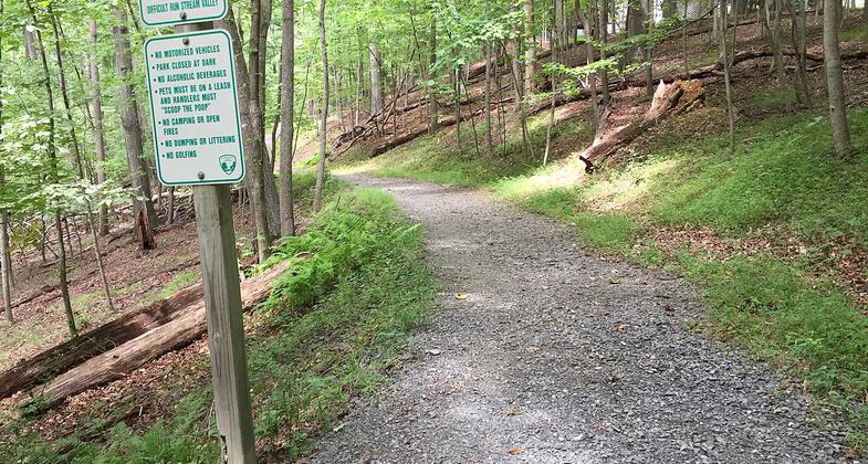
View north along the Gerry Connolly Cross County Trail between Miller Heights Road and Vale Road in Oakton, Fairfax County, Virg. Photo by Famartin.
Location: Fairfax County, Virginia, Follows Accotink and Difficult Run stream valleys through City of Fairfax west of Capital Beltway (Interstate 495).
- States: Virginia
- Counties: Fairfax, Fairfax
By anyone's reckoning, it's a unique and glorious achievement for one American county - a trail over 40 miles long connecting the entire county from one end to the other - the Gerry Connolly Cross County Trail of Fairfax County, Virginia.
Just as the trail itself connects hill and vale, stream, meadow, and urbanized landscapes, its very creation united government agencies with trail enthusiasts, environmentalists, citizen activists, and the private sector, no small undertaking for bustling Fairfax County.
The Gerry Connolly Cross County Trail has been divided into ten sections plus an additional section for the Laurel Hill Greenway for purposes of mapping. The individual section maps show neighborhood connections, parking, and amenities such as restrooms and water fountains.
Accessibility Information
No text provided.
Allowed Uses:
Bicycling Dogs, on leash Equestrian Hiking/Walking Snow, cross-country skiing Snow, snowshoeingOther Activities
- Snow, snow play general
Public Contact
Tom McFarlandFairfax County Park Authority
12055 Pate-Trail Coordinator
Fairfax, VA 22035
[email protected] • (703) 324-8688
www.fairfaxcounty.gov/parks/trails/cross-county-trail
Contact the trail manager for current maps and visiting details.
More Details
- Elevation (low): --
- Elevation (high): --
- Elevation (cumulative): --
- Part of a Trail System? No
- National Designations: Community Millenium
- Surface (primary): Soil
- Surfaces (additional): Paved, Boardwalk, Rock, crushed, Sand, Soil
- Tread Width (average): 72"
- Tread Width (minimum): --
- Running length (minimum): --
- Tread Grade (average, percent): 6
- Tread Grade (maximum): 20
- Running length (maximum): --
- Cross-slope (average, percent): --
- Cross-slope (maximum): --
- Running length (maximum): --
- Certified as an NRT
May 31, 2007

