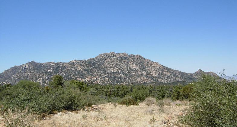
Granite Mountain
check with the trail manager for updated details before visiting.
Granite Mountain
USDA Forest Service
Backcountry Trail
- Length
4 miles
- Elevation Gain
--
- Route Type
out & back
- Length
4 miles - Elevation Gain
-- - Route Type
out & back
One in a network of trails serving Granite Mountain Wilderness.
Location: West of Prescott in Prescott National Forest above Granite Basin Lake.
- States: Arizona
Granite Mountain Trail #261 is the first leg of a 6-mile loop starting near Granite Basin Lake and traveling counter-clockwise around Little Granite Mountain using Little Granite Mountain Trail #37 and Clark Spring Trail #40. Granite Mountain Trail #261 also provides a day trip from the Granite Basin Recreation Area up to Blair Pass and into the heart of Granite Mountain Wilderness. Despite its proximity to the city of Prescott, this area is a sanctuary for a diversity of wildlife. You may see javelina, deer, and foxes along the trail, as well as snakes, lizards, and a variety of Southwestern birds.
A short distance past the trailhead, the trail travels upward through open chaparral and boulders before climbing steeply into pinyon-juniper and ponderosa pine forest. There are a number of remarkable vistas that offer breathtaking views of the surrounding topography. This trail goes past peregrine falcon nesting sites on the south flank of Granite Mountain. Please stay on the trail during nesting season, from February 1 through July 31.
Accessibility Information
No text provided.
Allowed Uses:
Hiking/WalkingPublic Contact
Prescott National Forest344 South Cortez
Prescott, AZ 86303
Contact the trail manager for current maps and visiting details.
More Details
- Elevation (low): --
- Elevation (high): --
- Elevation (cumulative): --
- Part of a Trail System? No
- Surface (primary): --
- Surfaces (additional): --
- Tread Width (average): 0"
- Tread Width (minimum): --
- Running length (minimum): --
- Tread Grade (average, percent): --
- Tread Grade (maximum):
- Running length (maximum): --
- Cross-slope (average, percent): --
- Cross-slope (maximum): --
- Running length (maximum): --
- Certified as an NRT
Dec 17, 1978