Great Miami River Watershed Water Trail
check with the trail manager for updated details before visiting.

Great Miami River Watershed Water Trail
City, Town, or County
National Water Trail
- Length
291 miles
- Elevation Gain
--
- Route Type
out & back
- Length
291 miles - Elevation Gain
-- - Route Type
out & back
The Great Miami River Watershed Water Trail is located in southwest Ohio and includes 291 miles of paddling, fishing, and wildlife watching opportunities including three beautiful rivers and many smaller tributaries.

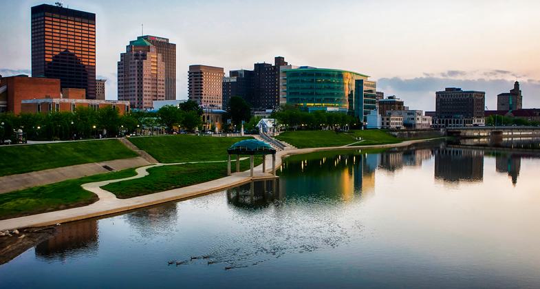
Dayton skyline. Photo by Jim Crotty.

Great Miami River Water Trail in Downtown Dayton

The River Run Mural, completed in 2015 on a Miami Conservancy District floodwall. Photo by Andy Snow.

Photo by Jim Crotty.

Photo by Jim Crotty.

Photo by Jim Crotty.

Photo by Jim Crotty.

Photo by Jim Crotty.
Location: The Great Miami River Watershed drains more than 4,000 square miles in all or parts of 15 counties in southwest Ohio. The major rivers include the Great Miami, Stillwater, and Mad rivers.
- States: Ohio
- Counties: Shelby, Logan, Miami, Montgomery, Greene, Champaign, Clark, Warren, Butler, Hamilton
- Cities/Townships: Cities Lakeview, Sidney, Piqua, Troy, Tipp City, Dayton, West Carrollton, Miamisburg, Fairfield, Hamilton, Cincinnati,
The Great Miami River Watershed Water Trail includes three major rivers and several smaller streams and collectively offers 291 miles and 117 public access sites. The name Miami was originally the designation of the tribe that bore the name of "Tewightewee." In the Ottawa language, it signified "mother" and the Shawanoese called the river 'Shi,me,a,mee,sepe', or Big Miamie River. The Miami Valley is known for its lush vegetation, abundant water resources, Ohio-Erie canal, and rich archeological past. Today, the Great Miami River corridor is known for its water supply, recreation, industries, productive farmland, and high-quality tributaries. The middle and upper mainstem contain some of Ohio's best smallmouth bass fishing. As a result of the watershed's glacial deposits, the Great Miami River flows over a buried aquifer with thick deposits of sand, gravel, cobble, and boulders. Its large watershed and abundant groundwater help to maintain good base flows throughout the year.
Great Miami River and tributaries
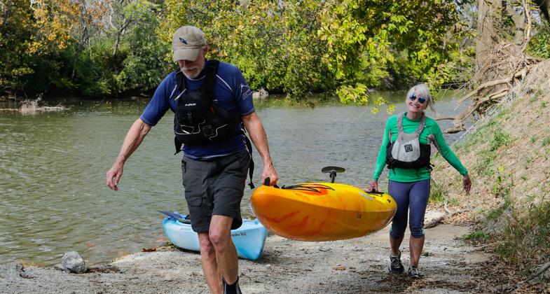
The Great Miami River Water Trail includes 156 miles and 60 public access points for trail users to paddle, boat, fish, wildlife watch, and enjoy. The Great Miami River has plenty of opportunities for beginner through advanced paddlers. A majority of the river is appropriate for hand-carried boats but there are several deeper sections where the use of motorized boats is popular. During summer low flows the river is a lazy paddle experience for much of its length. During higher flows extreme caution must be taken to safely navigate the river.
The river corridor begins in a rural environment and flows through farm fields and small villages. At river mile 128 the river flows past the first of several small cities and alternates between farm fields and streamside forests. Nearing the City of Dayton trail users must portage a large dam, Taylorsville, before the river flows through the urbanized environment. Around river mile 50 the Great Miami River continues to become much wider and deeper until its confluence with the Ohio River just west of Cincinnati. There are a total of 22 low-head dams on the river and one major dam that require portage.
Twin Creek is a major tributary of the Great Miami River and enters the Great Miami River at river mile 56.7. The Twin Creek offers ten public access points and boasts itself as the third healthiest stream segment in all of Ohio. There are excellent opportunities for fishing and wildlife watching.
Mad River and tributaries
Mad River, one of Ohio's only coldwater fisheries to support brown trout, is well known as a popular fishing and canoe and kayak destination. This includes the tributary of Buck Creek which features a popular kayak whitewater park. Frequented by trout clubs and canoeists, the Mad River is Ohio's longest coldwater stream.
Stillwater River and tributaries
The scenic beauty of the Stillwater River attracts paddlers and fishermen from all over the country. The Stillwater River supports an exceptional diversity of aquatic wildlife and great sport fishing. The Stillwater is an Ohio-designated Scenic River. With excellent habitat and good water quality, the Stillwater and Greenville Creek Scenic River system provides exceptional smallmouth bass fishing. Greenville Falls is located in a gorge west of Covington. Greenville Creek passes through a steep ravine and bluffs in this area and has been dedicated as a state nature preserve.
Accessibility Information
No text provided.
Allowed Uses:
Boating, motorized Boating, human-poweredOther Activities
- Camping
- Fishing
- Heritage and history
- Wildlife viewing / observation
Public Contact
Sarah Hippensteel HallMiami Conservancy District
38 E MONUMENT AVE
DAYTON, OH 45402
[email protected] • 937-223-1271
More Details
- Elevation (low): --
- Elevation (high): --
- Elevation (cumulative): --
- Part of a Trail System? No
- State Designations: Ohio Water Trail; portions are Scenic Rivers
- Surface (primary): --
- Surfaces (additional): Rock, boulders, Snow or ice, Water, calm
- Tread Width (average): 0"
- Tread Width (minimum): 0
- Running length (minimum): --
- Tread Grade (average, percent): --
- Tread Grade (maximum):
- Running length (maximum): --
- Cross-slope (average, percent): 0
- Cross-slope (maximum): --
- Running length (maximum): --
- Certified as an NRT
Jun 14, 2016


