Harlem Valley Rail Trail - Dutchess County
check with the trail manager for updated details before visiting.
Harlem Valley Rail Trail - Dutchess County
Nonprofit
Frontcountry Trail
Rail Trail
- Length
10.7 miles
- Elevation Gain
--
- Route Type
out & back
- Length
10.7 miles - Elevation Gain
-- - Route Type
out & back
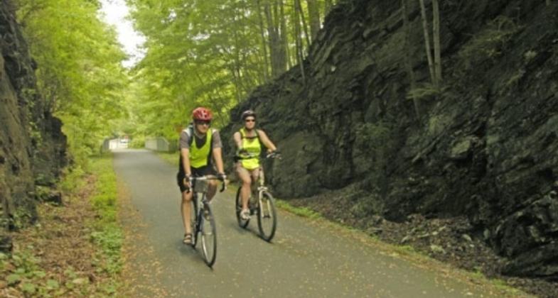
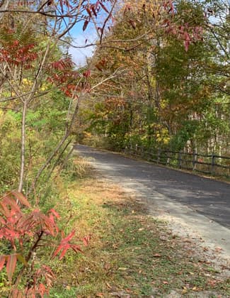
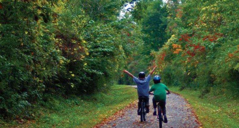
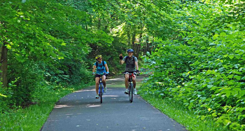
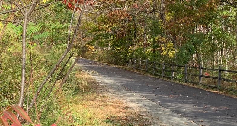
The Harlem Valley Rail Trail is a paved bicycle/pedestrian path built on the railbed of the old Harlem Line of the New York Central Railroad that connected New York City and the Town of Chatham. It is ideal for runners, bicyclists, walkers, roller-bladers, cross-county skiers, wheelchair users, hikers and dog walkers who enjoy combining the quiet beauty of rural landscapes with healthy exercise.

Location: Rail Trail that connects the Dutchess County Towns of Wassaic, NY to Millerton, NY and in Columbia County, Under Mountain Rd, Ancram NY to Taconic State Park Copake Falls NY.
- States: New York
- Counties: Dutchess
- Cities/Townships: Wassaic, Amenia, Northeast, Millerton, Ancram, Copake Falls, Copake and Hillsdale
It's not easy these days to get people outdoors unless the outdoors involves a rail trail. A 2012 survey found that 166,000 people used the Harlem Valley Rail Trail that year, an astonishing number at first glance, considering that the largest community it passes through numbers fewer than a thousand residents.
Parallel to the Hudson River and east of it by 25 miles or so, the Harlem Valley Rail Trail also parallels the New York-Connecticut and New York-Massachusetts borders just a few miles away. It starts about 90 miles north of New York City.
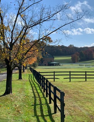
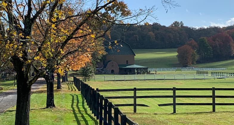
Its popularity surely starts with its natural beauty. Years ago, New York City residents took the New York Central line north out of town into the glorious rural hills and valleys of Dutchess and Columbia Counties. That possibility ceased in 1972 when service stopped. Fifteen years later a volunteer group formed to build a rail trail. Today, the Harlem Valley Rail takes visitors and residents along the same corridor to see much of the same sprawling horse and dairy farms and ancient mountains, thriving villages, and quiet hamlets. Nature's glory is everywhere evident.
Today's travelers are under their own power, at their own pace.
A valuable personal experience is exactly what the Harlem Valley Rail Trial offers. It's designed for all ages and has access at seven points, all with generous parking. It's safe, being isolated from vehicle traffic. It appeals to the entire range of human mobility, from racing cyclists and rollerbladers to those in strollers and wheelchairs. It's rich in the benefits of fresh air and sunlight. And it's enjoyable alone or in groups virtually year-round. It's designed and built with all modern safety features, including guardrails along steep portions, and all bridges, and road crossings are provided with ample signage and pavement markings. For those curious about local history, weatherproof displays describe local activities and events. (As an homage to the railroad, markers are in place every mile.) That a Trail user will see numerous birds, amphibians, and scurrying mammals is a foregone conclusion. The Trail provides a Botanical Guide, produced with the local chapter of the Audubon Society and the Cary Institute for Ecosystem Studies, at the several information kiosks along the Trail and also at the Trail's website, hvrt.org. To enjoy all of this in contemplation, benches, and cleared overlooks are provided at strategic points.
Today's Harlem Valley Rail Trail consists of about 14 miles of paved, limited-access surface in two pieces. The first extends ten miles north from the terminus of the Metro North's Harlem Valley commuter line at Wassaic to the heart of the historic village of Millerton. Along the way, it passes through the village of Amenia, forests, wetlands, fields, and meadows. The views are spectacular. The presence of nature is everywhere close and immediate.
The Rail Trail skirts ponds, traverses several trout streams, and ducks into a historic rock cut that in 1888 filled heavily with snow and caused an infamous train crash. It divides the Coleman Station Historic District, one of New York States' first rural historic districts, distinguished by farmsteads two centuries old and still intact and eight separate farmhouses listed on the National Register of Historic Places. A recently restored rural cemetery half a mile west on Coleman Station Road is worth a stop.
Millerton is a draw in itself these days. With its many shops, boutiques, art galleries, antique stores, nearly a dozen restaurants, and the region's best small film theatre, the beloved Moviehouse, Millerton is an excellent starting or end point for a Rail Trail excursion. Many Millerton business owners say the Rail Trail has helped the village economically, in response the village has added attractions for visitors such as a Saturday morning farmer's market at the Trail's head.
Just north, the second section feeds into Taconic State Park, one of New York's most interesting small parks, with a 40-foot waterfall, a large and beautiful natural swimming hole, the preserved remains of an ironworks, and superb hiking and camping.
In several years the two Rail Trail sections will be connected when Dutchess County supported by federal funds will build this eight-mile stretch. In the meantime, cyclists can connect the two sections themselves on a delightful country road that passes Rudd Pond State Park where they could stop for a swim.
The Harlem Valley Rail Trail is both a destination and a work in progress. The final section will stitch together several larger communities, culminating in Chatham, a regional hub. This eleven-mile section will traverse a variety of urban and suburban fabrics, as well as many patches of forest and field. At one point it will pass directly behind an elderly care facility, providing its residents easy access to beneficial exercise.
Our ultimate goal is a 46-mile continuous trail. We've just opened a new section from the village of Hillsdale south for walking, running, and off-road bike riding. In the meantime, what we have to offer is already revitalizing the communities it passes through and giving people for miles around a secure, beautiful place to get outdoors, exercise safely, and enjoy being surrounded by a richly rewarding natural world.
Accessibility Information
No text provided.
Allowed Uses:
Bicycling Dogs, on leash Hiking/Walking Snow, cross-country skiing Snow, snowshoeingOther Activities
- Snow, snow play general
- Wildlife viewing / observation
Public Contact
Lisa DeLeeuwHarlem Valley Rail Trail Association
Harlem Valley Rail Trail Association
Millerton, NY 12546
[email protected] • 518-789-9591
Contact the trail manager for current maps and visiting details.
More Details
- Elevation (low): 473
- Elevation (high): 701
- Elevation (cumulative): --
- Part of a Trail System? No
- State Designations: Hudson River Valley Greenway Trail
- Surface (primary): Paved
- Surfaces (additional): --
- Tread Width (average): 120"
- Tread Width (minimum): 120
- Running length (minimum): --
- Tread Grade (average, percent): 1
- Tread Grade (maximum):
- Running length (maximum): --
- Cross-slope (average, percent): 1
- Cross-slope (maximum): --
- Running length (maximum): --
- Certified as an NRT
Jun 2, 2014