Hartman Bar
check with the trail manager for updated details before visiting.
Hartman Bar
USDA Forest Service
Backcountry Trail
- Length
8 miles
- Elevation Gain
--
- Route Type
out & back
(1 review)
- Length
8 miles - Elevation Gain
-- - Route Type
out & back
Get away from the hustle and bustle to relax in the shade of a maple tree. The Hartman Bar National Recreation Trail offers a beautiful setting for a day or a weekend of fun.

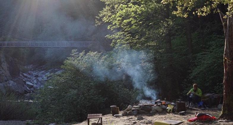
Hartman Bar Campsite. Photo by Jason Lynn - Truckee, CA.

Hartman Bar Heaven. Photo by Jason Lynn, Truckee, CA.
Location: In Plumas National Forest, 24 mi. NW of Feather Falls, joins Willow Creek Rd. and Hartman Bar Rd.
- States: California
- Counties: Plumas
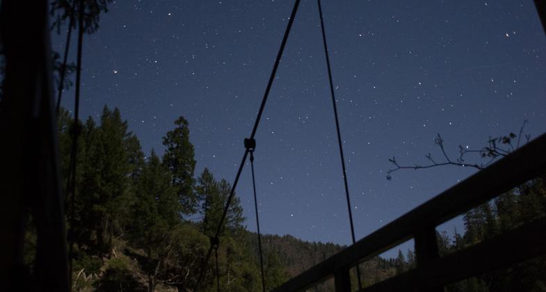
Hartman Bar Trail has two entry points on either side of the Middle Fork of the Feather River drainage, and the trail descends down to a suspension bridge that crosses the river. The nation's record Ponderosa pine tree can be found adjacent to this trail on the north rim. An undeveloped campsite is located on the south side of the river. A horse corral is located at each trailhead. This trail is not recommended for novice horse riders.
Hartman Bar North trailhead (approximate elevation 5,100') is located approximately 54 miles northeast of Oroville, California. The trail descends difficult but scenic terrain to the Middle Fork Feather River at 2,300' elevation over the course of 4.5 miles.
Hartman Bar South trailhead (approximate elevation 4,800') is located approximately 31 miles northeast of Feather Falls. The trail descends difficult but scenic terrain to the Middle Fork Feather River at 2,300' elevation over the course of 3.5 miles, ending at an undeveloped riverside camp. Please observe Leave No Trace principles and pack out all trash.
Accessibility Information
No text provided.
Reviews
Joseph Swails
A beautiful wilderness camp
It's not completely undeveloped, there are oil drum fire pits and an outhouse latrine. The trail is fairly short but a bit arduous if you aren't on a horse - especially coming back up from the valley! We saw several pieces of cast off camping gear, including two cast iron skillets - I suppose they didn't want to pack them out! But it's a quiet spot, the scenery is beautiful, with the gentle sound of flowing water to lull you to sleep!
Allowed Uses:
Equestrian Hiking/WalkingOther Activities
- Camping
- Fishing
- Wildlife viewing / observation
Public Contact
Michelle AhearnPlumas National Forest
Plumas National Forest
Oroville, CA 95965
[email protected] • (530) 534-6500
www.fs.usda.gov/pluma
Contact the trail manager for current maps and visiting details.
More Details
- Elevation (low): 2300
- Elevation (high): 5100
- Elevation (cumulative): --
- Part of a Trail System? No
- Surface (primary): Soil
- Surfaces (additional): --
- Tread Width (average): 21"
- Tread Width (minimum): 18
- Running length (minimum): --
- Tread Grade (average, percent): 12
- Tread Grade (maximum): 20
- Running length (maximum): --
- Cross-slope (average, percent): 20
- Cross-slope (maximum): --
- Running length (maximum): --
- Certified as an NRT
Dec 12, 1979


