Headquarters Trail
check with the trail manager for updated details before visiting.
Headquarters Trail
USDA Forest Service
Backcountry Trail
- Length
3.5 miles
- Elevation Gain
--
- Route Type
out & back
- Length
3.5 miles - Elevation Gain
-- - Route Type
out & back
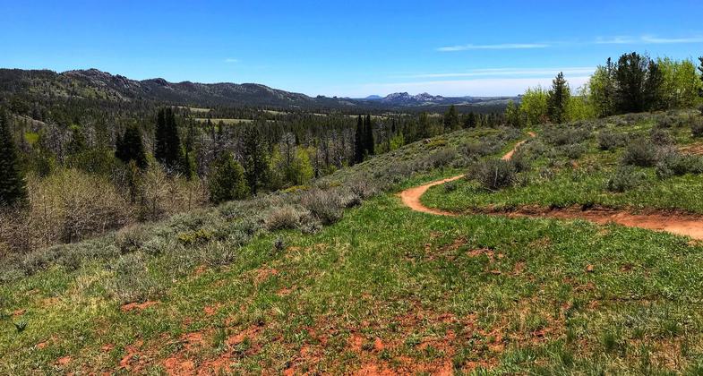
Ponderosa Pine groves, mixed with wildflower meadows and beautifully colored granite rock formations make this easily accessible trail a must for all outdoor enthusiasts.

On the trail looking south. Photo by Pam Riches.

East trailhead and parking area. Photo by Pam Riches.

On the trail looking east. Photo by Pam Riches.

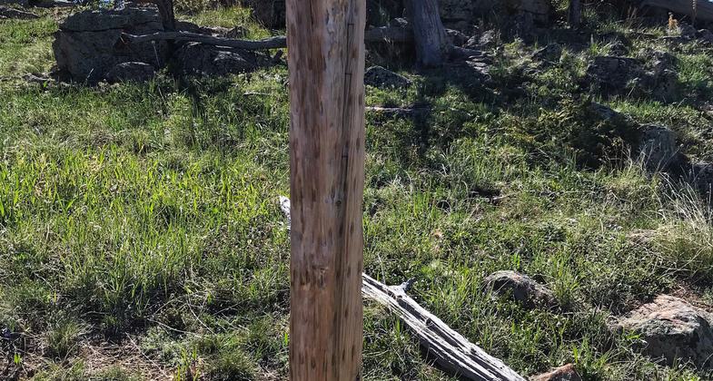
Watch for these 4x4 poles that mark the trail. Photo by Pam Riches.

West parking area. Photo by Pam Riches.

West trailhead. Photo by Pam Riches.

Headquarters Park Historic District, Medicine Bow National Forest, Carbon County, Wyoming. Photo by Magicpiano.
Location: 17 miles west of Laramie, WY at Summit Rest Area, in Medicine Bow National Forest E of Laramie, connects Headquarters Road to Upper Tie City Campground.
- States: Wyoming
- Counties: Albany
The Headquarters Trail accesses some of the most unique counties of this region. Ponderosa Pine groves, mixed with wildflower meadows and beautifully colored granite rock formations make this easily accessible trail a must for all outdoor enthusiasts. Hiking, biking, and horseback riding are the most popular activities found along the trail. In winter, portions of the trail are groomed for Nordic and skate skiing. Wildlife abounds during the spring, summer, and fall. Only 15 minutes from Laramie and 25 miles minutes from Cheyenne, this remarkable oasis is certainly worth stopping for when traveling in southeast Wyoming.
Accessibility Information
No text provided.
Allowed Uses:
Bicycling Dogs, on leash Equestrian Hiking/WalkingOther Activities
- Camping
- Fishing
Public Contact
Laramie Ranger District2468 Jackson St.
Laramie, WY 82070
(307) 745-2300
www.fs.usda.gov/main/mbr/home
Contact the trail manager for current maps and visiting details.
More Details
- Elevation (low): 7304
- Elevation (high): 8948
- Elevation (cumulative): --
- Part of a Trail System? No
- National Designations: National Millenium
- Surface (primary): Soil
- Surfaces (additional): Soil
- Tread Width (average): 48"
- Tread Width (minimum): --
- Running length (minimum): --
- Tread Grade (average, percent): 4
- Tread Grade (maximum): 8
- Running length (maximum): --
- Cross-slope (average, percent): --
- Cross-slope (maximum): --
- Running length (maximum): --
- Certified as an NRT
Dec 12, 1979


