Heaven's Gate
This information is a public record of the 1978 NRT application and may be out of date if it has not been updated by a trail manager --
check with the trail manager for updated details before visiting.
check with the trail manager for updated details before visiting.
Heaven's Gate
USDA Forest Service
Backcountry Trail
- Length
0.2 miles
- Elevation Gain
--
- Route Type
out & back
- Length
0.2 miles - Elevation Gain
-- - Route Type
out & back
Location: 15 miles west of Riggins on U.S. Highway 95 in Nez Perce National Forest.
- States: Idaho
- Counties: Idaho
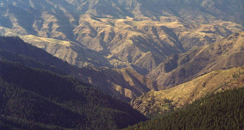
The Heaven's Gate National Recreation Trail #73 is located on the ridge overlooking Hells Canyon in Idaho. This short trail goes from the Heaven's Gate Trailhead to the overlook by the fire lookout tower. Traveling 0.2 miles through beautiful stands of old-growth whitebark pine, and colorful mountain flowers, visitors are rewarded with views of Hells Canyon clear across into Oregon. The trails also show signs of past wildfire activity which is common and natural in the canyon.
Accessibility Information
No text provided.
Allowed Uses:
Hiking/WalkingPublic Contact
Earl BaumgartenHells Canyon National Recreation Area
Wallowa-Whitman National Forest
Riggins, ID 83549
ebaumgar/[email protected] • (208) 628-3916
Contact the trail manager for current maps and visiting details.
More Details
- Elevation (low): --
- Elevation (high): --
- Elevation (cumulative): --
- Part of a Trail System? No
- Surface (primary): Soil
- Surfaces (additional): --
- Tread Width (average): 0"
- Tread Width (minimum): --
- Running length (minimum): --
- Tread Grade (average, percent): --
- Tread Grade (maximum):
- Running length (maximum): --
- Cross-slope (average, percent): --
- Cross-slope (maximum): --
- Running length (maximum): --
- Certified as an NRT
Dec 17, 1978


