Hells Revenge
check with the trail manager for updated details before visiting.
Hells Revenge
Bureau of Land Management
Frontcountry Trail
- Length
9.7 miles
- Elevation Gain
1700
- Route Type
Loop
- Length
9.7 miles - Elevation Gain
1700 - Route Type
Loop
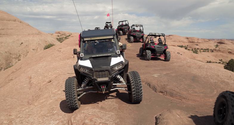
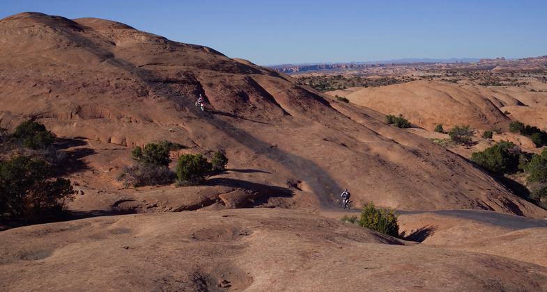
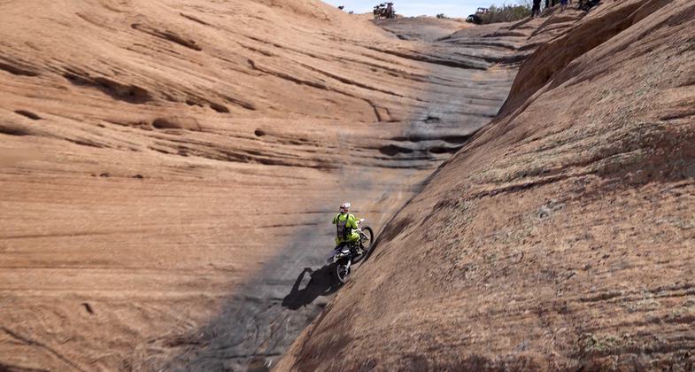
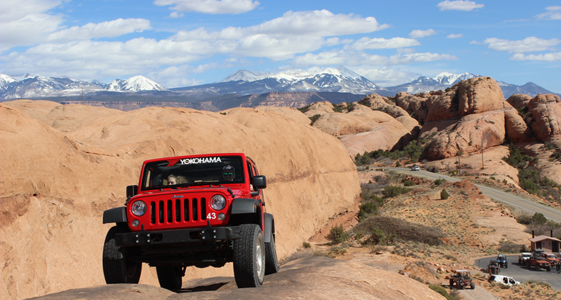
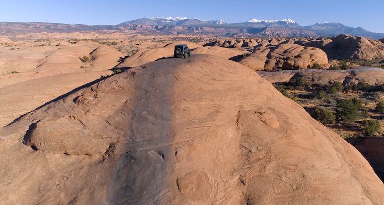
Moab's premier slickrock OHV trail consists of long stretches of slickrock with outstanding views throughout. The most difficult obstacles are out of the stock-vehicle class, but those can be bypassed. In addition to full-size vehicles, the trail is popular with smaller vehicles such as UTVs and motorcycles. Trail is not suitable for ATVs due to safety issues. There are steep climbs and descents and some edges that are not for the faint of heart. The steep slopes, however, are not technically difficult because of the excellent traction on sandstone. In a few places, the trail crosses the now-famous "Slickrock Bike Trail," a designated National Recreation Tail used by motorcycles and mountain-bikes.


Location: Out and back trail just inside the Sand Flats Recreation Area about 2 miles from the center of Moab, UT
- States: Utah
- Counties: Grand
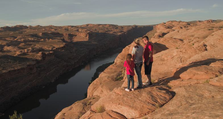
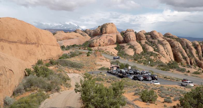
Moab Utah is a world-renowned destination for OHV activities, including "jeeping", UTV and motorcycle riding. Trail is not suitable for ATVs due to safety issues. The most popular OHV trail near Moab is Hells Revenge, located just outside of town and within The Sand Flats Recreation area. This area is Bureau of Land Management (BLM), land but day-to-day management is under the auspices of Grand County, Utah, as part of a long-standing agreement with BLM. The trail totals 9.7 miles, including optional bypasses at challenging obstacles and several optional short-cuts for those who wish a less lengthy outing.. Except for a short distance at the beginning, the trail is two-way. The complete look accesses the Sand Flats Road about one mile below the official start. Due to deteriorating road conditions, less appealing scenery, the potential for futures access issues across private land and safety issues, this segment receives little use, with most users exiting at the same point they began. For this reason, this spur is not included in the NRT nomination. The trail is almost entirely on Navajo Sandstone, a geologic formation popularly known as "slickrock". This surface forms rolling dome and ridge features resembling petrified sand dunes. This surface, besides producing exceptional scenery, provides outstanding traction for motorized passage even on the steepest slopes. In addition to private users, the trail is very popular with tour operators and OHV rental businesses, primarily due to the very easy access from town. The trail is a features part of the annual Easter Jeep Safari event, which has been held for over fifty years. The trail's challenges begin right at the start with a steep climb on a narrow sandstone fin, providing a taste of the many challenges to come. The trail consist of numerous slickrock fins and domes, some of which have significant drop-offs which can be intimidating to those with fears of exposure. At several points along the trail, there are short alternates which provide even more challenging terrain. These features (Tip-over challenge, the Escalator and Hells Gate) are well-known to OHV enthusiasts, and are featured in numerous guidebooks and web postings. The driving challenges inherent in the trail attract many enthusiasts but perhaps its main attraction is the all-encompassing views of the landscape which has made the Moab area a world-class destination. The views never cease, and include Arches and Canyonlands National Parks, the Colorado Rover Gorge, several Wilderness Study Areas (WSAs) surrounding Moab, and the outstanding landscape of the Sand Flats Recreation Area.
Accessibility Information
Most use is by 4WD vehicles, including full-size and ATV/UTVs. These vehicles can be driven by most people with disabilities. A paved parking area at the trail's start provides for relatively easy unloading of trailered vehicles. It is also legal to drive licensed vehicles on paved roads from town itself.
Allowed Uses:
Bicycling Bicycling, electric Bicycling, hand powered, recumbents, tricycles Dogs, on leash Hiking/Walking Motorized vehicles, – ATV/ORV Motorized vehicles, – four-wheel drive Motorized vehicles, motorcycling Trail runningPublic Contact
William Stevens, Outdoor Recreation PlannerBLM
82 E Dogwood
Moab, UT 84532
[email protected] • 4352592101
More Details
- Elevation (low): 4455
- Elevation (high): 4763
- Elevation (cumulative): 1700
- Part of a Trail System? No
- Surface (primary): Rock, smooth
- Surfaces (additional): Sand
- Tread Width (average): 120"
- Tread Width (minimum): 120
- Running length (minimum): 51200
- Tread Grade (average, percent): --
- Tread Grade (maximum): 33.6
- Running length (maximum): --
- Cross-slope (average, percent): 0
- Cross-slope (maximum): 0
- Running length (maximum): 0
- Certified as an NRT
May 31, 2024