High Wallowa Trail
check with the trail manager for updated details before visiting.
High Wallowa Trail
USDA Forest Service
Backcountry Trail
- Length
2 miles
- Elevation Gain
--
- Route Type
out & back
- Length
2 miles - Elevation Gain
-- - Route Type
out & back

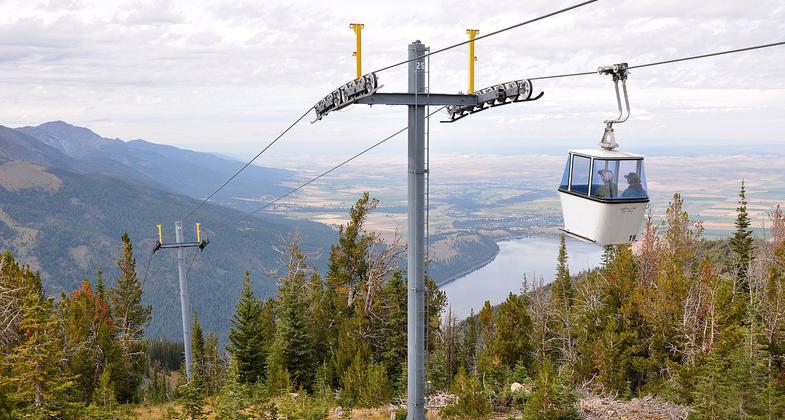
Wallowa Lake Tramway near Joseph, Oregon, in the United States. The tramway ascends Mount Howard in the Wallowa Mountains. Photo by Finetooth.
Location: In Wallowa-Whitman National Forest on summit of Mt. Howard, accessed by gondola from Wallowa Lake.
- States: Oregon
- Counties: Wallowa
The High Wallowa Loop National Recreation Trail (#1813) is composed of a main loop trail and two side spurs going to the Royal Purple Overlook and the northern overlook. All three trails total about 1.2 miles. The trail begins on top of Mount Howard at the Wallowa Lake Tramway building and loops around the mountain top. The summit provides spectacular views of the Wallowa Mountains, the deep blue waters of Wallowa Lake, the majestic peaks of the Eagle Cap Wilderness, the distant Seven Devil Mountains of Idaho, and the Wallowa Valley below with the communities of Joseph, Enterprise, and Wallowa in the distance. The gondola is the steepest vertical lift for a four-passenger gondola in North America.
Accessibility Information
No text provided.
Allowed Uses:
Hiking/WalkingPublic Contact
Faith KennyWallowa-Whitman National Forest
P.O. Box 907
Baker, OR 97814
(541) 523-1205
Contact the trail manager for current maps and visiting details.
More Details
- Elevation (low): --
- Elevation (high): --
- Elevation (cumulative): --
- Part of a Trail System? No
- Surface (primary): --
- Surfaces (additional): --
- Tread Width (average): 0"
- Tread Width (minimum): --
- Running length (minimum): --
- Tread Grade (average, percent): --
- Tread Grade (maximum):
- Running length (maximum): --
- Cross-slope (average, percent): --
- Cross-slope (maximum): --
- Running length (maximum): --
- Certified as an NRT
Apr 1, 1981

