Highline Loop
This information is a public record of the 1979 NRT application and may be out of date if it has not been updated by a trail manager --
check with the trail manager for updated details before visiting.
check with the trail manager for updated details before visiting.
Highline Loop
USDA Forest Service
Backcountry Trail
- Length
17 miles
- Elevation Gain
--
- Route Type
Loop
- Length
17 miles - Elevation Gain
-- - Route Type
Loop
The trail travels 17.0 miles through mountain parks, aspen groves, and spruce/fir forest, and along alpine ridge tops above timberline.
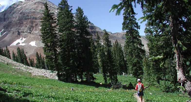
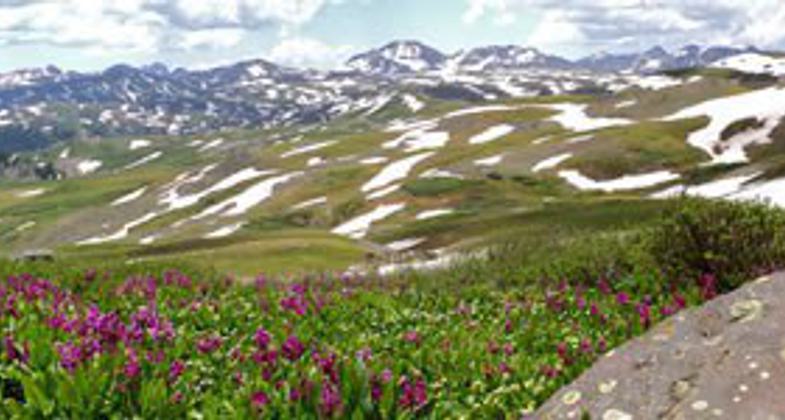
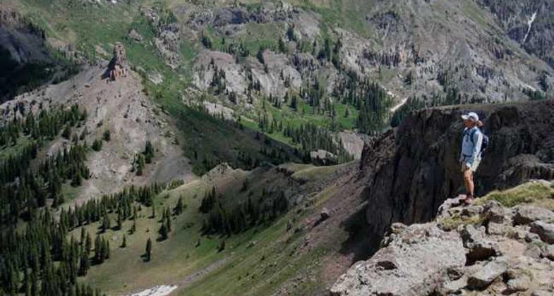
San Juan National Forest. Photo by USFS.
San Juan National Forest. Photo by USFS.
San Juan National Forest. Photo by USFS.
Location: In San Juan NF, NW of Durango at Kennebec Pass.
- States: Colorado
- Counties: Montezuma
Several trails traverse the high country, including the Highline Loop National Recreational Trail. The trail travels 17.0 miles through mountain parks, aspen groves, and spruce/fir forest, and along alpine ridge tops above timberline. It is a high elevation trail that is somewhat difficult to follow. Excellent views of Hermosa Creek can be seen from the trail.
Accessibility Information
No text provided.
Allowed Uses:
Dogs, on leash Hiking/WalkingOther Activities
- Camping
Public Contact
Darren UptainSan Juan National Forest
Dolores Ranger District
Dolores, CO 81323
[email protected] • (970) 882-7296
www.fs.usda.gov/detail/sanjuan/about-forest/districts/?cid=stelprdb
Contact the trail manager for current maps and visiting details.
More Details
- Elevation (low): 9000
- Elevation (high): 12000
- Elevation (cumulative): --
- Part of a Trail System? No
- Surface (primary): Paved
- Surfaces (additional): Rock, boulders, Rock, smooth, Soil
- Tread Width (average): 18"
- Tread Width (minimum): --
- Running length (minimum): --
- Tread Grade (average, percent): 12
- Tread Grade (maximum): 20
- Running length (maximum): --
- Cross-slope (average, percent): --
- Cross-slope (maximum): --
- Running length (maximum): --
- Certified as an NRT
Nov 15, 1979