Hulls Gulch Interpretive Trail
check with the trail manager for updated details before visiting.
Hulls Gulch Interpretive Trail
Bureau of Land Management
Backcountry Trail
- Length
3 miles
- Elevation Gain
--
- Route Type
out & back
- Length
3 miles - Elevation Gain
-- - Route Type
out & back

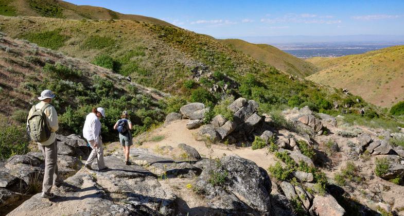
Hikers along the upper section of the Hulls Gulch Interpretive Trail. Photo by Larry Ridenhour.

Family hiking Hulls Gulch Interpretive Trail. Photo by Larry Ridenhour.

Hulls Gulch Trailhead Sign. Photo by Larry Ridenhour.

Hulls Gulch Sunflowers. Photo by BLM Idaho/wiki.

Hulls Gulch. Photo by BLM Idaho/wiki.
Location: Foothills above Boise, Idaho. 7 miles north of downtown Boise on 8th Street Road.
- States: Idaho
- Counties: Ada
Reconnect with the natural world outside the hustle and bustle of downtown Boise on the Hulls Gulch Interpretive Trail. Hulls Gulch is a great place to learn about the unique natural history of the Boise Foothills and surrounding valley. To help maintain these qualities, the trail is for pedestrians only. Bicyclists and equestrians will enjoy other trail opportunities in the Ridge to Rivers Trail System.
Bring plenty of water and be prepared for desert conditions. The road past the 8th Street Trailhead can be pretty rough and at times may not be passible to regular passenger vehicles. The trail can also be accessed from the 8th Street Trailhead.
Accessibility Information
No text provided.
Allowed Uses:
Hiking/WalkingPublic Contact
Bureau of Land ManagementFour Rivers Field Office
Boise, ID 83705
[email protected] • (208) 384-3300
Contact the trail manager for current maps and visiting details.
More Details
- Elevation (low): 3800
- Elevation (high): 5000
- Elevation (cumulative): --
- Part of a Trail System? No
- Surface (primary): Soil
- Surfaces (additional): Soil
- Tread Width (average): 30"
- Tread Width (minimum): --
- Running length (minimum): --
- Tread Grade (average, percent): 8
- Tread Grade (maximum): 20
- Running length (maximum): --
- Cross-slope (average, percent): --
- Cross-slope (maximum): --
- Running length (maximum): --
- Certified as an NRT
May 1, 1980

