Ides Cove Loop
check with the trail manager for updated details before visiting.
Ides Cove Loop
USDA Forest Service
Backcountry Trail
- Length
10.7 miles
- Elevation Gain
--
- Route Type
Loop
- Length
10.7 miles - Elevation Gain
-- - Route Type
Loop
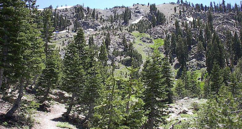
The Ides Cove Trail extends approximately nione miles. The hiker will pass through open scattered timber, and meadow-type vegetation and have views of the Sacramento Valley, Cottonwood Creek Canyon, and the North Yolla Bolly Peaks.
Location: Scenic/Natural, Corning.
- States: California
- Counties: Tehama
The Ides Cove Trail extends approximately nine miles. The hiker will pass through open scattered timber, and meadow-type vegetation and have views of the Sacramento Valley, Cottonwood Creek Canyon, and the North Yolla Bolly Peaks.
From the trailhead, you travel northwest. After about a half miles distance, turn west at the trail junction and travel about another mile to Square Lake. It's only about another mile from Square Lake to Long Lake. It's about two miles to the next trail junction. At this point turn east to reach Cedar Basin in about a mile's distance. After another mile you reach Burnt Camp; another mile and a half more takes you back to a junction with the Browns Camp Trail. It's only about a quarter mile west to the trailhead connector and a half mile more to the trailhead itself.
Accessibility Information
No text provided.
Allowed Uses:
Dogs, on leash Equestrian Hiking/WalkingOther Activities
- Camping
- Fishing
- Wildlife viewing / observation
Public Contact
Fred BellMendocino National Forest
825 N. Humboldt Ave.
Willows, CA 95988
(503) 934-1167
Contact the trail manager for current maps and visiting details.
More Details
- Elevation (low): --
- Elevation (high): --
- Elevation (cumulative): --
- Part of a Trail System? No
- Surface (primary): --
- Surfaces (additional): --
- Tread Width (average): 30"
- Tread Width (minimum): --
- Running length (minimum): --
- Tread Grade (average, percent): --
- Tread Grade (maximum):
- Running length (maximum): --
- Cross-slope (average, percent): --
- Cross-slope (maximum): --
- Running length (maximum): --
- Certified as an NRT
Dec 12, 1979


