Illinois River
check with the trail manager for updated details before visiting.
Illinois River
USDA Forest Service
Backcountry Trail
- Length
8 miles
- Elevation Gain
--
- Route Type
out & back
- Length
8 miles - Elevation Gain
-- - Route Type
out & back
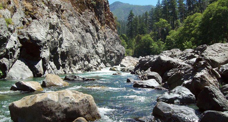
The Illinois River NRT is 8 miles long and goes from the trailhead at Oak Flat to Silver Creek.
Location: Siskiyou National Forest, Gold Beach Road, In Siskiyou National Forest, SE of Agness at Oak Flat trailhead.
- States: Oregon
- Counties: Curry
The trail enters the Kalmiopsis Wilderness at Connors Place, .5 miles before Silver Creek. The trail continues on the Galice Ranger District for another 17 miles, from Silver Creek to the trailhead at Briggs Creek. Although horses are allowed, this trail is only for very experienced trail horses and riders. The first 2.5 miles, from Oak Flat to Buzzard's Roost, is a favorite for people viewing wildflowers in the spring. The information concerning the trail applies only to the portion of the trail classified as a National Recreation Trail (the portion that is 8 miles on Gold Beach Road).
Accessibility Information
No text provided.
Allowed Uses:
Bicycling Swimming Dogs, on leash EquestrianOther Activities
- Camping
- Fishing
- Wildlife viewing / observation
Public Contact
Tom HawkinsSiskiyou National Forest
29279 Ellensburg
Gold Beach, OR 97526
[email protected] • (541) 247-3600
www.fs.fed.us/r6/siskiyou
Contact the trail manager for current maps and visiting details.
More Details
- Elevation (low): 250
- Elevation (high): 860
- Elevation (cumulative): --
- Part of a Trail System? No
- Surface (primary): Soil
- Surfaces (additional): Soil
- Tread Width (average): 24"
- Tread Width (minimum): --
- Running length (minimum): --
- Tread Grade (average, percent): 10
- Tread Grade (maximum): 20
- Running length (maximum): --
- Cross-slope (average, percent): --
- Cross-slope (maximum): --
- Running length (maximum): --
- Certified as an NRT
Nov 26, 1979


