Jackass Creek Trail
This information is a public record of the 1979 NRT application and may be out of date if it has not been updated by a trail manager --
check with the trail manager for updated details before visiting.
check with the trail manager for updated details before visiting.
Jackass Creek Trail
USDA Forest Service
Backcountry Trail
- Length
6.3 miles - Elevation Gain
-- - Route Type
out & back
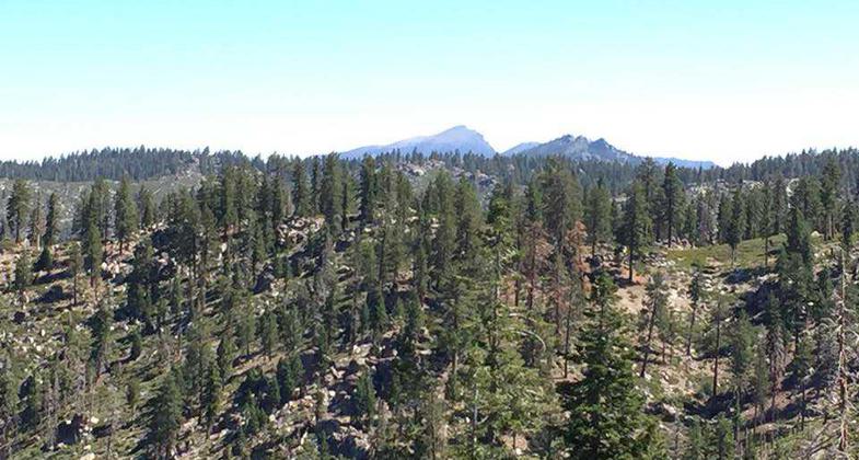


Location: Sequoia National Forest, Road 21501.
- States: California
- Counties: Tulare
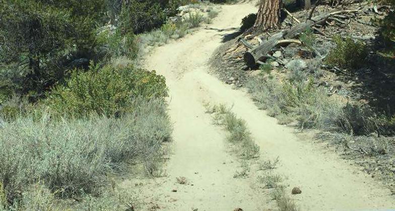
The Jackass Creek trail is 5.5 miles long. It begins at 22S05 and ends at 35E06. The trail is open for the following uses: motorcycle trail riding, mountain biking, and hiking.
Accessibility Information
No text provided.
Allowed Uses:
Hiking/Walking Motorized vehicles, motorcyclingOther Activities
- Camping
Public Contact
Mike MendozaSequoia National Forest
Cannell Ranger District
Kernville, CA 93238
mmendoza@fs.fed.us • (760) 376-3781
Contact the trail manager for current maps and visiting details.
More Details
- Elevation (low): 7000
- Elevation (high): 8000
- Elevation (cumulative): --
- Part of a Trail System? No
- Surface (primary): Soil
- Surfaces (additional): Soil
- Tread Width (average): 30"
- Tread Width (minimum): --
- Running length (minimum): --
- Tread Grade (average, percent): 8
- Tread Grade (maximum): 12
- Running length (maximum): --
- Cross-slope (average, percent): --
- Cross-slope (maximum): --
- Running length (maximum): --
- Certified as an NRT
Dec 12, 1979